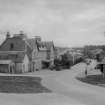
Carrbridge, New Bridge
Road Bridge (Period Unassigned)
Site Name Carrbridge, New Bridge
Classification Road Bridge (Period Unassigned)
Alternative Name(s) Carr Bridge, Road Bridge; River Dulnain
Canmore ID 112112
Site Number NH92SW 21
NGR NH 90663 22930
Datum OSGB36 - NGR
Permalink http://canmore.org.uk/site/112112
- Council Highland
- Parish Duthil And Rothiemurchus
- Former Region Highland
- Former District Badenoch And Strathspey
- Former County Inverness-shire
NH92SW 21.00 90663 22930
Location formerly cited as NH 9066 2293.
NH92SW 21.01 Cancelled: see NH92SW 12.
For predecessor bridge (adjacent to W), see NH92SW 12.
Photographs in the NMRS show the three different bridges which have replaced one another at this spot.
(Undated) information in NMRS.
This bridge carries the former line of the A9 public road (now the B9153) over the River Dulnain at the N end of the village of Carrbridge (NH92SW 23) and to the E of the (predecessor) Old Bridge (NH92SW 12). It is depicted, but not noted, on the 1982 edition of the OS 1:10,000 map.
Information from RCAHMS (RJCM), 28 March 2006.
Construction (1930 - 1939)
Concrete bridge of the 1930s has been superceeded.
R Paxton and J Shipway, 2007.
Publication Account (2007)
Carr Bridge
Historic Engineering Works no. HEW 2532
The remains, mainly the arch-ring, of a rubble stone almost semicircular arch bridge over the Dulnain, built in 1717. It had a width between parapets of 7 ft and the steepness of the roadway at each side of the arch indicates that the bridge was intended for pedestrian and horse usage. It is said to have been known as a funeral bridge because it facilitated the carrying of coffins to the burial ground and was reputed to have been built at the expense of the Parish by John Niccelsone, a mason, and cost £100.
Sir Owen Williams’ slender reinforced concrete openframe arch bridge of the 1930s (NH92SW 21.0), was replaced by the present bridge.
R Paxton and J Shipway, 2007.
Reproduced from 'Civil Engineering heritage: Scotland - Highlands and Islands' with kind permission from Thomas Telford Publishers.


