
Scheduled Maintenance
Please be advised that this website will undergo scheduled maintenance on the following dates: •
Tuesday 3rd December 11:00-15:00
During these times, some services may be temporarily unavailable. We apologise for any inconvenience this may cause.
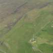
Skye, Kilmuir Church, Clachan


Burial Ground (Medieval), Church (Medieval), Grave Slab (17th Century), Grave Slab (Medieval)
Site Name Skye, Kilmuir Church, Clachan
Classification Burial Ground (Medieval), Church (Medieval), Grave Slab (17th Century), Grave Slab (Medieval)
Alternative Name(s) Kilmaluag
Canmore ID 11204
Site Number NG37SE 1
NGR NG 3999 7175
Datum OSGB36 - NGR
Permalink http://canmore.org.uk/site/11204


- Council Highland
- Parish Kilmuir
- Former Region Highland
- Former District Skye And Lochalsh
- Former County Inverness-shire
NG37SE 1 3999 7175.
NG 3999 7175 Chapel (NR) (Ruins of)
OS 6" map, Inverness-shire, 2nd ed., (1904)
Kilmuir parish was anciently named Kilmaluag, and the church stood at Kilmaluag on the NE coast of the parish. After the Reformation the church of Kilmuir, dedicated to St Mary, and situated on the NW coast, seems to have become the parish church. Its cemetery remains, but the present church, built in 1810, stands on a different site (OPS 1854).
Of the old church nothing remains (M E M Donaldson 1923).
The graveyard, Reileag Mhoir Choirn Donvill, burial place of the Macdonalds of the Isles, is sadly neglected (Donaldson 1923). In it stands the broken tomb of Flora Macdonald, who died in March 1790, and the probably late 17th century grave-slab of Charles Mackarter (Macarthur) celebrated piper of the Macdonalds (RCAHMS 1928).
Donaldson (Donaldson 1923) considers the accepted dedication of the church to St Mary (see Martins map {M Martin 1934}) to be wrong but is alone in this belief. Johnstons Map of Skye (1824) shows 'Kirk' at NG 390 716) without dedication.
Orig Paroch Scot 1854; M E M Donaldson 1923; RCAHMS 1928; M Martin 1934; S Gordon 1950.
RCAHMS make no mention of this church but there can be little doubt that the building shown as a ruin on the original 25" survey was Kilmuir Chapel. Although the plan can no longer be made out,a thick stone wall at the site, built about 12 years ago by a crofter from the rubble heap which stood here, is composed of stones many of which still have mortar adhering to them. The site, which occupied a small shelf on a S. facing slope, is still known locally as the site of Kilmuir Chapel.
Note: The 1810 church referred to by (OPS 1854) situated at NG 381 709, is now disused and ruinous.
Visited by OS (C F W) 26 April 1961.
Site of church in a ploughed field and generally as described by previous OS field surveyor.
Visited by OS (I S S) 9 September 1971.
Field Visit (28 May 1914)
Effigy, Kilmuir Churchyard.
In Kilmuir Churchyard is a stone slab 6 feet 3½ inches in length and 2 feet 1 inch in breadth, bearing the effigy of a knight in armour carved on it in high relief. The figure represents a man with a conical helmet (bascinet) on the head, with a camail on the shoulders over a quilted coat reaching to the knees. The hands encased in glaives are held in front, the left hand, with knuckles outward, grasping the top of his sword sheath, in which is a sword 3 feet 6 ½ inches in length with depressed quillons and a fan-shaped pommel divided into seven segments. The sword belt and attachment on either side of the hand are still visible with a buckle suspended. The right hand, palm outwards, holds an indeterminate object, perhaps the end of the belt. The figure measures 5 feet 7 inches in length to the heels, the feet and the object on which they rest having been obliterated.
To the dexter side of the head is a plain uninscribed panel, while in the sinister are two rectangular panels with an inscription in Gothic characters running longitudinally, which, so far as legible, reads: HIC JA CETE
Round the edge of the slab is an incised double beading, and on the flat on either side of the waist is a foliaceous design.
RCAHMS 1928 No. 536, visited 28 May 1914.
OS map: Skye iv (unnoted).
Field Visit (28 May 1914)
Carved Slab, Kilmuir Churchyard.
Another slab, 6 feet 1 inch in length and 1 foot 8 inches in breadth at the top, 1 foot 7 ½ inches at the bottom, bears a galley or lymphad in a shield in the upper part with a two-handed sword below, measuring 3 feet 10 inches in length. On the dexter side of the hilt is the figure of a stag and another animal placed longitudinally on the stone, and on the sinister side is another animal, perhaps a lion rampant. On either side of the blade is a foliaceous design.
GRAVE SLAB. A grave slab, probably late 17th century, bears the following incomplete inscription:
HERE LYES / THE REMAINS OF / CHARLES MAC / KARTER WHOSE / FAME AS AN HON / EST MAN AND / REMARKABLE PIP / ER WILL SURVIVE / THIS GENERATION / FOR HIS MANNERS / WERE EASY & RE / GULAR AS HIS / MUSIC AND THUS THO / THE MELODY OF / HIS FINGERS WILL . . .
On the MacArthurs as pipers see New Stat. Acct., XIV., p. 285.
RCAHMS 1928 No. 537, visited 28 May 1914.
OS map: Skye iv (unnoted).

