
Scord Quarry


Cairn (Period Unassigned), Cist (Period Unassigned)
Site Name Scord Quarry
Classification Cairn (Period Unassigned), Cist (Period Unassigned)
Alternative Name(s) Outnabrake; Outnabreck Hill; Wind Hamars
Canmore ID 1120
Site Number HU44SW 5
NGR HU 4142 4003
Datum OSGB36 - NGR
Permalink http://canmore.org.uk/site/1120


- Council Shetland Islands
- Parish Tingwall
- Former Region Shetland Islands Area
- Former District Shetland
- Former County Shetland
HU44SW 5 4142 4003.
HU 415 402. A very ruinous cairn lies at the south end of the grass-grown ridge of Wind Hamars and between 200 and 300 yards north of the main road. 'The western segment is utterly destroyed on the edge of a steep decline and only a very short arc of the out- line is traceable on the south and south east; only a rough measure of 31 1/2' NE to SW is obtainable. Towards the SW portion of the interior a cist of slabs on edge is well-defined and measures 4' 6" long by 3' 5" wide. A few feet to the north of it there are two rows of three boulders each, set in parallel alignment; the rows are spaced about 5' apart and are closed at the north end by a boulder set transversely in a formation suggesting an extra large cist or probably a small chamber.'
C S T Calder 1965.
Corrected Grid Reference HU 413 401. Very enigmatic but the cist is clear and as described by Calder except that one side seems to be straight. It is too ruined for classification and is not to be included as a chambered cairn. At HU 4138 4001.
A S Henshall, Chambered Tombs Ms and Annotated offprint of Calder's article.
Cairn with cist as described above.
Visited by OS (R L) 4 May 1968.
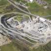
This very ruined cairn on Outnabrake Hill above Scord Quarry was investigated and found to consist of a rectangular cist c1.5m by 1m and two parallel rows of boulders running north from the cist for c4.5m at a distance of c1.5m to 1.6m apart. These features were enclosed in a small rubble matrix and peat over a layer of larger rubble within peat which, in turn, lay directly on bedrock.
The lower cairn appeared to have concave N and S limits. The other limits to the E and W no longer exist having been lost to two quarry roads incised into the hill on either side of the monument.
The central cist was sectioned and a sample was taken of the contents, two layers of dark brown, humic-rich, peaty soil, speckled throughout with fragmented vein quartz.
Finds from the cairn comprised 2 pieces of pumice, a pot sherd and a stone bead (all of which came from the rubble matrix). It is possible that the larger rubble indicates that this cairn may be one of Henshall's heel-shaped type cairns.
A second potential cairn to the SW of the first was investigated and found to be no more than a collection of large stones lying above the peat. Two samples of burnt material were taken from below the peat and above the bedrock.
After completing the excavations the entire tongue of land beyond the quarry was investigated to attempt to locate further archaeological anomalies. None were found.
J Hamilton 1990.
Scheduled as Outnabreck Hill, cairn.
Information from Historic Scotland, scheduling document dated 5 March 1993.

