
Westhaugh


Shaft (Period Unassigned)
Site Name Westhaugh
Classification Shaft (Period Unassigned)
Canmore ID 111968
Site Number NS89NE 67
NGR NS 8854 9584
Datum OSGB36 - NGR
Permalink http://canmore.org.uk/site/111968

- Council Clackmannan
- Parish Alloa
- Former Region Central
- Former District Clackmannan
- Former County Clackmannanshire
NS89NE 67 8854 9584
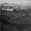
A disused shaft, which is depicted on the 1st edition of the OS 6-inch map (Perth and Clackmannan 1866, sheet cxxxiii), is not shown on the current edition of the OS 1:10000 map (1992).
Information from RCAHMS (PM) 26 August 1996

