
Following the launch of trove.scot in February 2025 we are now planning the retiral of some of our webservices. Canmore will be switched off on 24th June 2025. Information about the closure can be found on the HES website: Retiral of HES web services | Historic Environment Scotland
Bowhouse, Air Ministry Munitions Factory


Armament Depot (20th Century), Munitions Factory (20th Century)
Site Name Bowhouse, Air Ministry Munitions Factory
Classification Armament Depot (20th Century), Munitions Factory (20th Century)
Alternative Name(s) Woodhead
Canmore ID 111621
Site Number NS43SE 15
NGR NS 467 348
NGR Description Centred NS 467 348
Datum OSGB36 - NGR
Permalink http://canmore.org.uk/site/111621


- Council East Ayrshire
- Parish Riccarton
- Former Region Strathclyde
- Former District Kilmarnock And Loudoun
- Former County Ayrshire
NS43SE 15 centred 467 348
Also falls on OS 1:10000 scale map sheet NS43NE
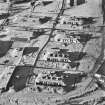
Visible on OS vertical air photographs 65/8/700-1 and 84/228/112-14.
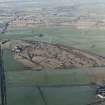
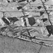
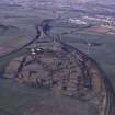
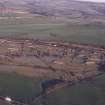
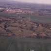
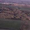
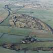
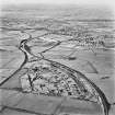
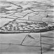
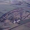
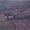
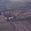
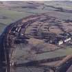
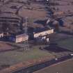
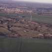
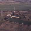
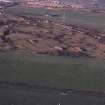
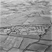
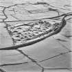
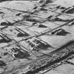
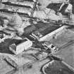
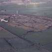
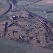
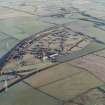
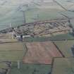
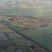
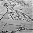
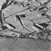
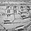
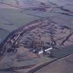
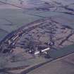
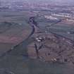
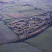
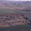
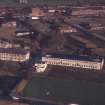
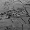
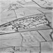
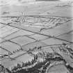
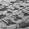
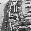
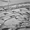
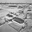
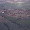
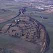
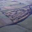
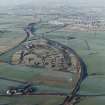
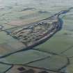
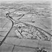
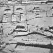
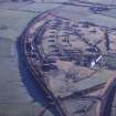
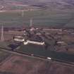
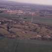
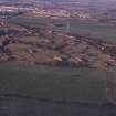
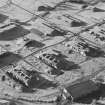
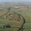
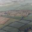
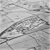
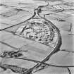
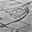
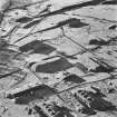
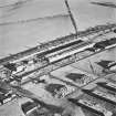
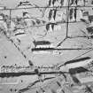
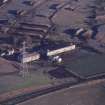
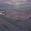
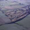
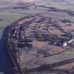
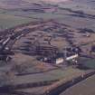
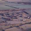
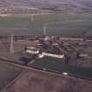
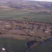
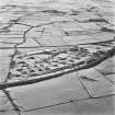
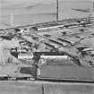
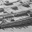
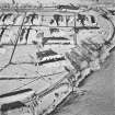
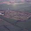
This shell and bomb filling factory is situated to the SE of Hurlford E of the A76 (T) road and immediately S of the Kilmarnock to Carlisle railway. The site had been completely cleared by March 1998 to allow the construction of a new prison.
J Guy 2001; NMRS MS 810/11, Vol.1, 168-9
Munitions factory has now been demolished and HM Prison built on the site.
Information from RCAHMS (DE), February 2008
Archaeological Evaluation (25 November 1996 - 9 December 1996)
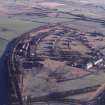
NS 466 349 A field and desk study of the WWII munitions factory at Bowhouse (constructed 1939) produced a wealth of information on the site and its workings.
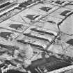
The desk study, using both written and oral sources, allowed a detailed history of the site to be compiled. Particular emphasis was given to the incendiary bomb production phase, as Bowhouse was one of only two such production centres in the British Isles during WWII.
Site description
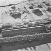
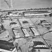
The factory covers an area of c.1km by 400m. The W part of the site contains the administration buildings, incorporating an 18th-century farmhouse. Skirting the N perimeter are the loading and unloading warehouses. The bulk of the site contains heavily fortified production buildings and packing houses, turfed over for camouflage purposes, each with its own blast bank and air-raid shelters. The whole complex was served by an internal railway system, linking to the main Kilmarnock to Carlisle railway line, which passes close by the site.
Site phasing
1 The period of bomb construction, 1939-45.
1a The addition of buildings to the E end of the site, c 1941.
2 Use of the site as a bomb dismantling site, 1950s.
3 Use of the site as a depot, 1950s-1968.
4 Subsequent non-military uses (horse and greyhound stables, small workshops), 1969-present.
Fuller report lodged with the NMRS (MS/725/146)
Sponsor: Scottish Prison Services.
K Speller and C French 1997

