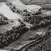
Accessibility

Font Size

100% 150% 200%

Background Colour

Default Contrast
Close Reset

Mains Of Kilravock

Farmhouse (Period Unassigned), Farmstead (Period Unassigned)

Site Name Mains Of Kilravock

Classification Farmhouse (Period Unassigned), Farmstead (Period Unassigned)

Canmore ID 111486

Site Number NH84NW 77

NGR NH 8135 4965

Datum OSGB36 - NGR

Permalink http://canmore.org.uk/site/111486

Ordnance Survey licence number AC0000807262. All rights reserved.
Canmore Disclaimer. © Bluesky International Limited 2025. Public Sector Viewing Terms

Toggle Aerial | View on large map

Digital Images

General oblique aerial view centred on the castle with the farmhouse and farmsteading adjacent, taken from the SE.

Administrative Areas

  • Council Highland
  • Parish Croy And Dalcross (Nairn)
  • Former Region Highland
  • Former District Nairn
  • Former County Nairn

References

MyCanmore Image Contributions


Contribute an Image

MyCanmore Text Contributions