
Pricing Change
New pricing for orders of material from this site will come into place shortly. Charges for supply of digital images, digitisation on demand, prints and licensing will be altered.
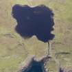
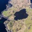
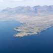
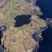
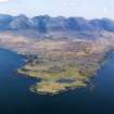
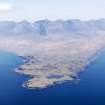
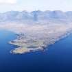
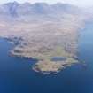
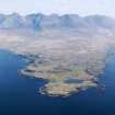
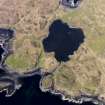
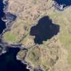
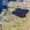
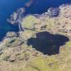
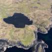
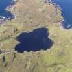
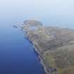
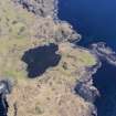
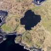
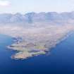
Skye, Creag A'chapuill


Enclosure (Period Unassigned)
Site Name Skye, Creag A'chapuill
Classification Enclosure (Period Unassigned)
Alternative Name(s) Rubh' An Dunain; Rudh' An Dunain
Canmore ID 11027
Site Number NG31NE 7
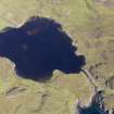
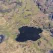
NGR NG 398 162
Datum OSGB36 - NGR
Permalink http://canmore.org.uk/site/11027


- Council Highland
- Parish Bracadale
- Former Region Highland
- Former District Skye And Lochalsh
- Former County Inverness-shire
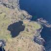
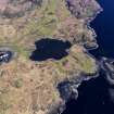
NG31NE 7 398 162.
The group of hut circles at the foot of the slope below the cave (NG31NE 5) may well represent the hamlet whose successive generations of Beaker stone-knappers and Iron Age iron-smelters came up to work in the cave.
W L Scott 1934.
Below the cave, at NG 398 162 , there is a roughly circular ring of stones, some 15.0m in diameter, in close proximity to a ruined cottage. It is more likely to be the vestigial remains of a small yard/enclosure than a hut-circle. No other feature resembling a hut-circle was found in the area, and Mr Maclean of Glen Brittle who is familiar with the locale had no knowledge of any hut-circles hereabouts.
Visited by OS (C F W) 9 April 1961.

