
Pricing Change
New pricing for orders of material from this site will come into place shortly. Charges for supply of digital images, digitisation on demand, prints and licensing will be altered.
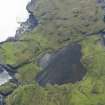
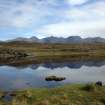
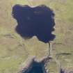
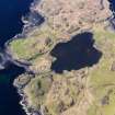
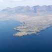
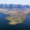
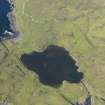
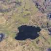
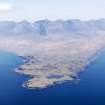
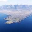
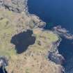
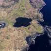
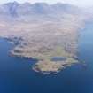
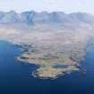
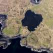
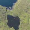
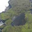
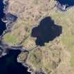
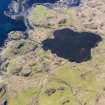
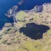
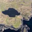
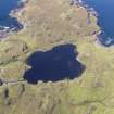
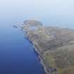
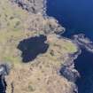
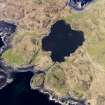
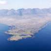
Skye, Rubh' An Dunain


Cairn (Prehistoric)(Possible), Cairn (Prehistoric)
Site Name Skye, Rubh' An Dunain
Classification Cairn (Prehistoric)(Possible), Cairn (Prehistoric)
Alternative Name(s) Rudh' An Dunain
Canmore ID 11026
Site Number NG31NE 6
NGR NG 3929 1639
Datum OSGB36 - NGR
Permalink http://canmore.org.uk/site/11026


- Council Highland
- Parish Bracadale
- Former Region Highland
- Former District Skye And Lochalsh
- Former County Inverness-shire
NG31NE 6 3929 1639.
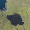
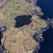
On the Rudh'an Dunain peninsula, in the neighbourhood of Loch na h'Airde, are two cairns - one of moderate size standing to a height of 5', and one small.
W L Scott 1934.
At NG 3929 1639 on a small ridge between Loch na h'Airde and Camas a Mhurain, a few feet above sea level, and about 50.0m WNW of the chambered cairn, is a cairn measuring 11.5m SE-NW and 12.5m transversely and 1.1m in height.
Some 20.0m to the W, occupying a similar position on the same ridge, is a small indeterminate heap of stones which is probably Lindsay Scott's 'small' cairn but it is rather doubtful.
Visited by OS (C F W) 8 April 1961.

