
Pricing Change
New pricing for orders of material from this site will come into place shortly. Charges for supply of digital images, digitisation on demand, prints and licensing will be altered.
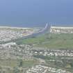
Nairn Harbour, West Pier


Pier (Period Unassigned)
Site Name Nairn Harbour, West Pier
Classification Pier (Period Unassigned)
Alternative Name(s) Nairn, The Harbour, West Breakwater; River Nairn
Canmore ID 110254
Site Number NH85NE 54.01
NGR NH 88868 57463
NGR Description NH 88868 57463 to NH 88875 57277
Datum OSGB36 - NGR
Permalink http://canmore.org.uk/site/110254


- Council Highland
- Parish Nairn
- Former Region Highland
- Former District Nairn
- Former County Nairn
NH85NE 54.01 88868 57463 to 88875 57277
Formerly entered as NH85NE 127.01 at cited location NH 8886 5730.
Pier [Nat] (centred NH 8885 5737)
OS 1:10,000 map, 1978.

