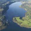
Lochaline, Old Pier
Pier (Period Unassigned)
Site Name Lochaline, Old Pier
Classification Pier (Period Unassigned)
Alternative Name(s) Sound Of Mull; Lochaline, The Quay
Canmore ID 108841
Site Number NM64SE 20
NGR NM 6796 4462
Datum OSGB36 - NGR
Permalink http://canmore.org.uk/site/108841
- Council Highland
- Parish Morvern
- Former Region Highland
- Former District Lochaber
- Former County Argyll
NM64SE 20 6796 4462
Pier [NAT]
OS 1:10,000 map, 1976.
Not to be confused with Lochaline, Old Pier (NM 6735 4422), for which see NM64SE 25.
For adjacent Ferry Pier, see NM64SE 13.
Lochaline (NM 679 447). Droved cattle from Fishnish, Mull were landed at Lochaline. In 1843 it was recorded that 'Underneath the village, a substantial pier has been constructed by the proprietor', this being the only such work noted in the parish of Morvern.
(Lochaline, The Quay). The pier faces E across the narrows at the mouth of the loch. From the S, it is approached along 32ft (9.7m) of quay in the N end of which a flight of nine steps descending towards the pier is inset. From this point, the quay curves outwards through 90 degrees to form the S side of the 54ft (16.4m) square quay. An 18ins (0.46m) long block in the kerb is cut to the shape of the curve. A large iron ring is set in the surface of the quay, about 2ft (0.6m) back from the curve. The SE corner of the pier head is also curved. Near the NE corner there is one old wooden pawl. A slip about 20ft (6.1m) wide rises along the N side of the pier.
Across the mouth of the loch another, less developed, landing place is visible, perhaps for a ferry.
NSA 1845; A Graham and J Gordon 1988.


