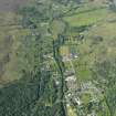
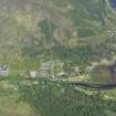
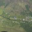
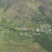
Strontian, Drumnatorran Bridge
Road Bridge (Period Unassigned)
Site Name Strontian, Drumnatorran Bridge
Classification Road Bridge (Period Unassigned)
Alternative Name(s) Strontian River; Strontian Bridge
Canmore ID 108483
Site Number NM86SW 40
NGR NM 81622 62431
Datum OSGB36 - NGR
Permalink http://canmore.org.uk/site/108483
- Council Highland
- Parish Ardnamurchan
- Former Region Highland
- Former District Lochaber
- Former County Argyll
Upstream, an impressive three-arched granite bridge, earlier 19th century, links Drimnatorran Farm to the ribbon of crofting townships that runs up the west side of the river. The highlight here is an unusually large U-plan steading/bank barn, 1828, built by Sir James Miles Riddell as part of an ambitious and progressive agricultural enterprise.
Taken from "Western Seaboard: An Illustrated Architectural Guide", by Mary Miers, 2008. Published by the Rutland Press http://www.rias.org.uk
NM86SW 40 81622 62431
Not to be confused with the bridge at NM 8140 6169, for which see NM86SW 50.
(Location cited as NM 817 625). Bridge, Strontian, 18th to 19th century. A three-span bridge, built, unusually for the area, of dressed stone. There are two main elliptical spans, with a smaller flood-relief arch.
J R Hume 1977.
This bridge carries the track leading to Drumnatorran farmhouse and steading (NM86SW 41.00 and .01 respectively) over the Strontian River.
Information from RCAHMS (RJCM), 14 November 2000.


