Accessibility

Font Size

100% 150% 200%

Background Colour

Default Contrast
Close Reset

Pricing Change

New pricing for orders of material from this site will come into place shortly. Charges for supply of digital images, digitisation on demand, prints and licensing will be altered. 


Montrose, Kinnaber Junction

Railway Junction (19th Century) - (20th Century)

Site Name Montrose, Kinnaber Junction

Classification Railway Junction (19th Century) - (20th Century)

Canmore ID 107584

Site Number NO76SW 59

NGR NO 71272 61908

Datum OSGB36 - NGR

Permalink http://canmore.org.uk/site/107584
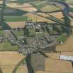
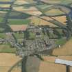
Ordnance Survey licence number AC0000807262. All rights reserved.
Canmore Disclaimer. © Bluesky International Limited 2025. Public Sector Viewing Terms

Toggle Aerial | View on large map

Digital Images

Administrative Areas

  • Council Angus
  • Parish Montrose
  • Former Region Tayside
  • Former District Angus
  • Former County Angus

Archaeology Notes

NO76SW 59 7113 6198

Kinnaber Junction [NAT]

OS 1:10,000 map, 1976.

References

MyCanmore Image Contributions


Contribute an Image

MyCanmore Text Contributions