
Pricing Change
New pricing for orders of material from this site will come into place shortly. Charges for supply of digital images, digitisation on demand, prints and licensing will be altered.
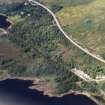
Lochluichart Station


Railway Station (19th Century) - (20th Century)
Site Name Lochluichart Station
Classification Railway Station (19th Century) - (20th Century)
Canmore ID 107495
Site Number NH36SW 7
NGR NH 32336 62572
Datum OSGB36 - NGR
Permalink http://canmore.org.uk/site/107495


- Council Highland
- Parish Contin
- Former Region Highland
- Former District Ross And Cromarty
- Former County Ross And Cromarty
NH36SW 7 32336 62572
Lochluichart Station [NAT]
OS (GIS) MasterMap, April 2010.
Location formerly entered as NH 3233 6258.
For (associated) Railway Cottages (to NE), see NH36SW 17.

