
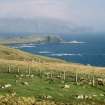
Canna, Tarbert Bay


Hut (Period Unassigned), Mound(S) (Period Unassigned), Structure (Period Unassigned), Flake (Flint)(Period Unassigned), Unidentified Pottery (Period Unassigned)
Site Name Canna, Tarbert Bay
Classification Hut (Period Unassigned), Mound(S) (Period Unassigned), Structure (Period Unassigned), Flake (Flint)(Period Unassigned), Unidentified Pottery (Period Unassigned)
Canmore ID 10735
Site Number NG20NW 5
NGR NG 2493 0563
Datum OSGB36 - NGR
Permalink http://canmore.org.uk/site/10735


- Council Highland
- Parish Small Isles
- Former Region Highland
- Former District Lochaber
- Former County Inverness-shire
NG20NW 5 2493 0563.
A = (NG 2600 0547) A large mound, probably a wheelhouse and one or two small circular huts.
B = (NG 2558 0554) Circular beehive hut.
C = (NG 2517 0575) Two circular huts and one large mound, probably a wheelhouse.
Private 6" map of T C Lethbridge, 1953.
These remains could not be located with any certainty. Mound 'C' is probably the remains of a circular structure at NG 2493 0563 visible as a disturbed irregular mound.
An arc of contiguous earthfast blocks (apparently part of an outer wall face) is visible in the S and W and others are visible intermittently elsewhere giving an overall diameter of 15.5m. The interior is turf-covered with many stones visible though the turf but with no intelligible pattern. The SE arc is mutilated and there are indications of later ruinous structures having been built on the N, E and S arcs. Its classification is uncertain through it is undoubtedly a dwelling. About 65.0m to the WNW are the remains of two adjacent turf-covered stone-walled structures of uncertain classification but possibly houses. They appear to be circular, each about 7.0m in diameter. A few fragments of a stone wall can be seen running W from the more southerly of the two.
In the area extending for about 250.0m E of the large structure, are the turf-covered remains of about fifteen shieling-type structures, one of which could be Lethbridge's "circular beehive hut" 'B'.
Surveyed at 1/10,000.
Visited by OS (I S S) 27 May 1972.
Formerly classified as shieling-huts; settlement at NG 2493 0563: reclassified as hut; mounds; stone; structures; pottery and miscellaneous finds centred at NG 2427 0620).
This large circular grass-grown mound, upon which traces of at least five superimposed structures and one subrectangular hut can be seen, lies on the line of a modern fence that extends along a terrace cultivated with lazy-beds (NG20NW 131.03) to the SSW of Beinn Tighe. The mound appears to incorporate a massive circular structure some 14m in overall diameter and has an external kerb of boulders up to 0.8m in length and 0.7m in height. In places, the mound has been disturbed by rabbit burrowing, but from the upcast flint chips, two sherds of pottery, fragments of a metal object, a spindle-whorl and a perforated whetstone have all been recovered. The latter two items were found in the summer of 1996 by one of the islanders. The superimposed structures are poorly defined, ranging from a small cell some 1.8m in diameter within a wall up to 1.5m thick, which appears to be attached to a larger cell or small enclosure on the E, to a subrectangular hut measuring 6m by 4m overall.
About 45m to the SW, towards the leading edge of the terrace, there is a stone that appears to have been set upright. Rectangular in section, it measures 0.9m by 0.6m at ground level and 1.1m in height.
Overlooking the mound from the terrace above, there are four mounds, one of which contains an oval structure. Two of the mounds (NG 2490 0567 and NG 2488 0564), which incorporate large stones, are similar in size, measuring 8.7m by 5.4m and 8.8m by 6.8m respectively, and they are probably the remains of collapsed huts or buildings. The south-western of these two mounds lies immediately NE of the mound containing the oval structure (NG 2487 0563), which is defined by a boulder wall up to 1.7m thick. Internally, the structure measures 5.7m from NNE to SSW by 3.8m transversely, the mound is up to 0.6m in height on the SSW, where there are also traces of an orthostatic wall that extends along the edge of the terrace. This mound has been damaged also by rabbit burrowing and during the course of the survey two sherds of pottery and several pieces of slag were found in the upcast from the burrows. The fourth mound (NG 2492 0568) is set at the foot of the crag at the back of the terrace and measures 4.3m from E to W by 3.7m.
Another low grass- and heather-grown mound (NG 2495 0569) belonging to this group is situated on the edge of the crag above. Subrectangular on plan, it measures 5m from N to S by 3.5m.
(Canna 198-99, 203-7 and 961-6)
Visited by RCAHMS (ARG), 12 March 1996
A flint flake and two sherds of pottery, one of which belongs to the base of a flat-bottomed vessel, were recovered from the northern half of this mound during fieldwork in May 2001. All were found in the upcast of rabbit burrows into one of the superimposed structures (NG 2493 0562).
(Finds to be deposited in the NMS).
Visited by RCAHMS (ARG, SPH), 10 May 2001.
Measured Survey (12 March 1996)
RCAHMS surveyed the mound and structures at Tarbert Bay, Canna on 12 March 1996 with plane-table and alidade at a scale of 1:250. The plans were later redrawn in ink.

