
Woodhead


Building(S) (19th Century), Miners Row(S) (19th Century)
Site Name Woodhead
Classification Building(S) (19th Century), Miners Row(S) (19th Century)
Canmore ID 106179
Site Number NX59SW 1.02
NGR NX 529 936
NGR Description Centred NX 529 936
Datum OSGB36 - NGR
Permalink http://canmore.org.uk/site/106179

- Council Dumfries And Galloway
- Parish Carsphairn
- Former Region Dumfries And Galloway
- Former District Stewartry
- Former County Kirkcudbrightshire
NX59SSW 1.02 centred 529 935
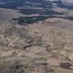
There are the remains of workers' housing, garden plots and other buildings on the E slopes of Knockower. The building remains at NX 5296 9359 are depicted as roofed and annotated as 'School' on the 1st edition of the OS 25-inch map (Kircudbrightshire 1850, sheets V and IV). The building is annotated as 'Shooting Lodge' on the 2nd edition OS 25-inch map (Kircudbrightshire 1893, sheet VII.10).
The 'Higher Row' (NX 5291 9365) and the 'Lower Row' (NX 5288 9368) are depicted as roofed and annotated on the OS 25-inch map (Kircudbrightshire 1893, sheet VII.10). There are also remains of garden plots and lazy bedding in the area of the housing. The housing was built as part of the Woodhead industrial community (1839-1873) by Colonel M. Cathcart.
Visited by RCAHMS (GJD) 30 July 1990; Information from RCAHMS (MMD) 14 August 1996; J Sassoon 1969
There are also remains of reservoirs at NX 528 940 and 'vein' workings at NX c. 527 940.
Information from Mrs Anna Campbell, Holm of Daltallochan, Castle Douglas, Kircudbrightshire.
Standing Building Recording (13 July 2022 - 25 August 2023)
NX 52964 93598 A building survey was undertaken at Woodhead Lead Mine, Carsphairn. The works were carried out by volunteers supported by Rathmell Archaeology staff. The mine at Woodhead was a rare example of a total production unit in Scotland – one which mined, crushed, washed and smelted the lead before it was exported – but it was also a village: the landowner who established the mine built housing, a school and even founded a library for the workers so that they could form their own community in this remote setting. The building survey aimed to generate a record of the historic fabric of the structures before they deteriorate any further and comprised a photographic record, a written record, and sketched plans and elevations of the existing structures. Focusing on the buildings at the western end of the mining complex, seven structures were recorded, which included the manager’s house and office, two rows of miners’ cottages, stables, a powder magazine and a school. The structures vary in their state of survival; while none remain roofed, the height of the standing walls range from one or two courses up to full height. Over 300 photographs were generated from the survey, capturing information on fabric, current condition and varying phases of modification and use.
Information from C. Williamson - Rathmell Archaeology Ltd, 2023.
OASIS ID: rathmell1-437549

