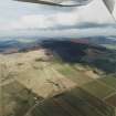
Accessibility

Font Size

100% 150% 200%

Background Colour

Default Contrast
Close Reset

Brae Of Scurdargue

Farmstead (Period Unassigned)

Site Name Brae Of Scurdargue

Classification Farmstead (Period Unassigned)

Canmore ID 105939

Site Number NJ42NE 75

NGR NJ 4773 2873

NGR Description NJ 4773 2873 and NJ 4782 2880

Datum OSGB36 - NGR

Permalink http://canmore.org.uk/site/105939

Ordnance Survey licence number AC0000807262. All rights reserved.
Canmore Disclaimer. © Bluesky International Limited 2025. Public Sector Viewing Terms

Toggle Aerial | View on large map

Digital Images

Oblique aerial view looking across the farmsteads towards the vitrified fort, taken from the SW.
Oblique aerial view looking across the farmsteads towards the vitrified fort, taken from the SW.Oblique aerial view looking across the farmstead towards the Garioch with the remains of the vitrified fort adjacent, taken from the W.

Administrative Areas

  • Council Aberdeenshire
  • Parish Rhynie
  • Former Region Grampian
  • Former District Gordon
  • Former County Aberdeenshire

Archaeology Notes

NJ42NE 75 4773 2873 and 4782 2880

The pre-improvement toun of Brae of Scurdargue is depicted on an estate plan of AD 1776 held by the National Archives of Scotland.

Information from RCAHMS (PJD) 16 June 2006

References

MyCanmore Image Contributions


Contribute an Image

MyCanmore Text Contributions