Following the launch of trove.scot in February 2025 we are now planning the retiral of some of our webservices. Canmore will be switched off on 24th June 2025. Information about the closure can be found on the HES website: Retiral of HES web services | Historic Environment Scotland
Glasgow, North Canal Bank Street, Pinkston Power Station
Power Station (20th Century)
Site Name Glasgow, North Canal Bank Street, Pinkston Power Station
Classification Power Station (20th Century)
Alternative Name(s) Port Dundas; Tramway Power Station
Canmore ID 105874
Site Number NS56NE 207
NGR NS 59580 66690
NGR Description Centred NS 59580 66690
Datum OSGB36 - NGR
Permalink http://canmore.org.uk/site/105874
- Council Glasgow, City Of
- Parish Glasgow (City Of Glasgow)
- Former Region Strathclyde
- Former District City Of Glasgow
- Former County Lanarkshire
NS56NE 207 centred 59580 66690
Power Station [NAT]
OS 1:1250 map, 1973.
Pinkston Power Station, built 1900-1 for the electrification of the Corporation tramways. Harry B Measures, engineer, London (£100,000). An interesting red brick structure, with high single-storey, 7-bay boiler house and engine halls side by side, and originally identical. The windows are round-headed with semicircular windows above and the wall tops are waved. Pilasters divide the bays, and are extended above the cornice, terminating in small pediments.
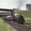
At the north end are two large brick chimneys with ornamental tops. The cooling tower, built 1952-4, was at the time of construction the largest in Europe.
J R Hume 1974.
Watching Brief (10 October 2006 - 23 November 2006)
NS 595 666 On behalf of British Waterways, and at the request of Historic Scotland, repair work undertaken between 10 October-23 November 2006 on the Pinkston Basin in the Port Dundas complex was monitored. This repair work included repointing stonework, replacement of coping stones, and dewatering of the basin. Some evidence of the development of the Basin complex after 1836 with the addition of the Timber Basin after 1842 and alterations to the adjacent canal walls was noted. Further evidence of wharf infrastructure associated with coking during the later-19th century and with the Pinkston Power Station of 1900-01 was also recorded.
Archive to be deposited with RCAHMS.
Funder: British Waterways, Scotland.
Watching Brief (January 2016)
NS 5946 6660 A watching brief was undertaken, January 2016, during site investigation works for a mixed use development at Port Dundas. The canal basin, which is a scheduled monument (6689), was backfilled by c1960, and dates to the second half of the 19th century. The site
investigation established that:
The base of the cooling tower for the power station was made of 0.35m of reinforced concrete, overlying the existing canalside infrastructure, some of which appeared to survive below the tower base.
The possible second cooling tower shown on the land registry title deeds was not present.
The basin itself was backfilled with made ground.
The warf sides and probable remains of the coke kilns were preserved across most of their original footprint. They survived at a depth of c0.15–0.80m below the current ground surface.
Archive: NRHE (intended). Report: NRHE and WoSAS
Funder: Waterman Structures Ltd (Waterman) on behalf of Farrans Construction
Magnus Kirby – CFA Archaeology Ltd
(Source: DES, Volume 17)
OASIS ID: cfaarcha1-269494


