Pricing Change
New pricing for orders of material from this site will come into place shortly. Charges for supply of digital images, digitisation on demand, prints and licensing will be altered.
Upcoming Maintenance
Please be advised that this website will undergo scheduled maintenance on the following dates:
Thursday, 9 January: 11:00 AM - 3:00 PM
Thursday, 23 January: 11:00 AM - 3:00 PM
Thursday, 30 January: 11:00 AM - 3:00 PM
During these times, some functionality such as image purchasing may be temporarily unavailable. We apologise for any inconvenience this may cause.
Lanark, Hyndford Road, Winston Barracks
Barracks (20th Century)
Site Name Lanark, Hyndford Road, Winston Barracks
Classification Barracks (20th Century)
Canmore ID 105460
Site Number NS94SW 57
NGR NS 91254 42200
NGR Description Centred on NS 91254 42200
Datum OSGB36 - NGR
Permalink http://canmore.org.uk/site/105460
- Council South Lanarkshire
- Parish Lanark
- Former Region Strathclyde
- Former District Clydesdale
- Former County Lanarkshire
NS94SW 57.00 91254 42200 Winston Barracks
NS94SW 57.01 NS 91247 42276 Barrack Block
NS94SW 57.02 NS 91333 42214 Barrack Block
NS94SW 57.03 NS 91284 42456 Barrack Block; Pavilion
NS94SW 57.04 NS 91174 42182 Gymnasium
NS94SW 57.05 Centred NS 91132 42228 Guardroom; Museum
NS94SW 57.06 NS 91449 42135 Warehouses; Sheds
NS94SW 57.07 Centred NS 91335 42349 Hospital Block; Boiler House; Buildings; Nissen Hut; Hut
NS94SW 57.08 NS 91166 42221 Workshop
NS94SW 57.09 Centred NS 91312 42533 Houses
NS94SW 57.10 NS 91051 42724 and NS 91078 42643 Rifle Range; Magazine
NS94SW 57.11 Centred NS 91572 42401 Sewage Works ; Water Treatment Works
NS94SW 57.12 Centred NS 91366 42109 Houses
NS94SW 57.13 NS 91352 42274 Building (NAAFI)
NS94SW 57.14 NS 91396 42391 Houses
NS 91254 42200 (centre) An evaluation consisting of desk-based assessment and trial trenching was undertaken at Winston Barracks (NMRS NS94SW 57) in advance of a new development. The desk-based assessment indicated the site was unimproved until the late 19th century and saw no significant activity before the military barracks were established. Trial trenching produced no evidence of significant archaeological deposits. The evaluation also indicated that archaeologically significant deposits are unlikely to be present within the development area due to the effects of ploughing and the construction and use of the barracks. (GUARD 957).
Sponsor: Baxter Bryce.
G MacGregor 2001
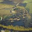
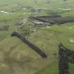
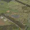
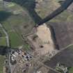
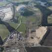
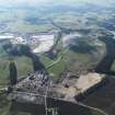
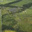
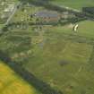
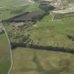
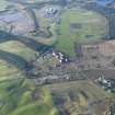
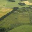
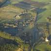
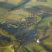
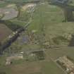
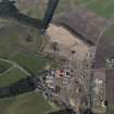
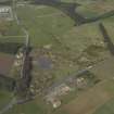
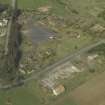
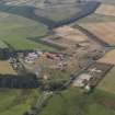
An almost complete pre 1940 infantry barracks is situated in the fork of the A73 and A70 trunk roads and E of Lanark Racecourse. The site occupies a total 22.52 hectares and incoporates barrack blocks, officer's quarters, NCO quarters, stores boiler houses a medical block, gymnasium, an assault course, firing and rifle ranges and other buildings.
The buildings are mainly in Neo-Georgian style, the most prominent is the main 'H' shaped barrack block on the N side of the parade ground. Most of the buildings were constructed between 1935 and 1939 with completion of the complex in 1940, as attested by the dates on the rain water hoppers found high on the S elevation of the main barrack block.
Winston Barracks were built to accommodate the Depot of the Cameronians (Scottish Rifles). The buildings were to "embody all the latest devices of permanent construction" (The Covenanter, May 1937) and the cost was estimated to be in the region of £150,000. In 1964 the Cameronians, now amalgamated with another regiment moved away from the barracks. The barracks were built in the Sandhurst style, which had been approved by the Royal Fine Arts Commission. The aim of the design and layout was to improve on prevous conditions in miltary establishments and incorporate the latest thinking in comfort and health. Around 250-300 men could be housed at any one time in the main H-shaped central block, which incoprorated a central dining hall, and cookhouses, with accommodation in the E and W wings. Various modern facilities were installed including central heating, hot water in the bathrooms, sitting rooms, drying rooms and storage rooms provided what was considered to be luxury accommodation all under one roof.
At the SE corner is further accommodation in the form of two storey houses which have been built over two periods.
On the E side of the A70 are the sewage works and storage sheds, the latter only one small building survives.
Since closure the barracks have lain empty and some buildings are now semi-derelict.
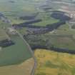
The disused Lanark Racecourse (NS94SW 55.00) was utilised during World War II for additional camp accommodation and aa a training area. A vertical air photograph taken in 1940 (614K, 398646, flown 28 August 1940), shows that the central area of the racecourse was used not only for a tented camp, but also for practice trench digging.
Visited by RCAHMS (DE), 21 November 2006


