
The Hows


Building (Medieval) - (Post Medieval), Enclosure(S) (Medieval) - (Post Medieval), Sheep Shelter (Medieval) - (Post Medieval)
Site Name The Hows
Classification Building (Medieval) - (Post Medieval), Enclosure(S) (Medieval) - (Post Medieval), Sheep Shelter (Medieval) - (Post Medieval)
Canmore ID 104702
Site Number NT71NE 124
NGR NT 7759 1637
Datum OSGB36 - NGR
Permalink http://canmore.org.uk/site/104702


- Council Scottish Borders, The
- Parish Hownam
- Former Region Borders
- Former District Roxburgh
- Former County Roxburghshire
Field Visit (3 November 1999)
NT71NE 124
The Hows
Building; Enclosure
NT 77593 16371
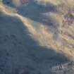
On the NW shoulder of The Hows there are the reduced remains of two buildings and an enclosure. The better preserved of the two buildings (NT 77598 16374) measures 22m from WNW to ESE by 4.3m transversely within turf and stone walls 0.5m in height and 1.8m thick. The interior slopes downhill to the W and possibly contains a drain; there is also an exterior drain along the N wall. There are entrances on the N and S walls. Extending from the S wall is a small D-shaped yard measuring 17m from WNW to ESE by 10m transversely. This building overlies the S end of an earlier turf building (NT 77590 16386) which measures 6.9m from N to S by 2.9m transversely, within walls up to 0.4m in height and 1.2m thick.
(KALE99 450-451)
Visited by RCAHMS (DCC) 3 November 1999, with additional information from RCAHMS (BM)
Sbc Note
Visibility: This is an upstanding earthwork or monument.
Information from Scottish Borders Council

