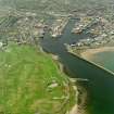
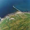
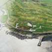
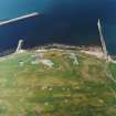
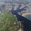
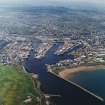
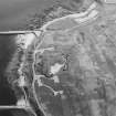
Aberdeen Harbour, Old South Breakwater
Breakwater (Period Unassigned)
Site Name Aberdeen Harbour, Old South Breakwater
Classification Breakwater (Period Unassigned)
Alternative Name(s) Aberdeen Harbour Entrance; Inner South Breakwater
Canmore ID 104094
Site Number NJ90NE 7.04
NGR NJ 9637 0572
NGR Description NJ 9637 0572 to NJ 9637 0581
Datum OSGB36 - NGR
Permalink http://canmore.org.uk/site/104094
- Council Aberdeen, City Of
- Parish Aberdeen
- Former Region Grampian
- Former District City Of Aberdeen
- Former County Aberdeenshire
NJ90NE 7.04 9637 0572 to 9637 0581
(Name cited as Inner South Breakwater).
NMRS, MS/712/84.
Not to be confused with Aberdeen Harbour, South Breakwater (NJ 9674 0570 to 9674 0600), for which see NJ90NE 7.05.
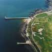
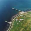
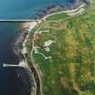
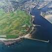
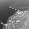
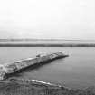
Inner South Breakwater. The construction of this breakwater was proposed by Thomas Telford. It was completed by 1840, reducing the susceptibility of the harbour entrance to silting and haevy weather.
Aberdeen City Council [2006].
Publication Account (2007)
A southern breakwater was completed in 1815 (NJ90NE 7.04) and another further east from 1870–73 (NJ90NE 7.05). From the pounding they receive from the sea both have required regular maintenance.
R Paxton and J Shipway, 2007.
Reproduced from 'Civil Engineering heritage: Scotland - Highlands and Islands' with kind permission from Thomas Telford Publishers.
Publication Account (2007)
South Breakwater
The first South Breakwater, nearly 800 ft long, was constructed under the superintendence of Gibb in consultation with Telford in 1812 to further restrict the channel and to protect the second North Pier extension. This work, which was successful, also increased the depth of the channel.
From 1870–73, as part of harbour entrance improvements, further protection from south-easterly gales was considered necessary particularly during construction of the third extension to the North Pier which was about to start.
Under Cay’s direction, a new South Breakwater was constructed of mass Portland cement concrete which in the lower part of the structure was ingeniously deposited from hoppers into bags each containing up to 100 tons ofconcrete. Above this level construction was achieved by means of large concrete blocks, the whole pier being 1050 ft long with a maximum height of 47 ft and a 62 ft high concrete lighthouse at the end. Divers prepared the sea bed before the bags were deposited. The effectiveness
of the pier during a storm in ca.1910 can be seen in the view. The seaward 500 ft of the old breakwater was removed in ca.1873.
R Paxton and J Shipway, 2007.
Reproduced from 'Civil Engineering heritage: Scotland - Highlands and Islands' with kind permission from Thomas Telford Publishers.


