
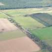
Strath Burn


Farmstead (Period Unassigned)
Site Name Strath Burn
Classification Farmstead (Period Unassigned)
Alternative Name(s) Mount High
Canmore ID 103925
Site Number NH76SW 24
NGR NH 709 606
Datum OSGB36 - NGR
Permalink http://canmore.org.uk/site/103925


- Council Highland
- Parish Rosemarkie
- Former Region Highland
- Former District Ross And Cromarty
- Former County Ross And Cromarty
Note
A farmstead comprising an unroofed T-shaped long building and an enclosure which may be another unroofed building is depicted on the 1st edition of the OS 6-inch map (Ross-shire and Cromartyshire 1880, sheet lxxviii), but it is not shown on the current edition of the OS 1:10000 map (1981).
Information from RCAHMS (SAH) 12 April 1996

