
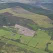
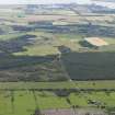
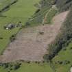
Inchindown


Farmstead (Period Unassigned)
Site Name Inchindown
Classification Farmstead (Period Unassigned)
Canmore ID 103873
Site Number NH67SE 40
NGR NH 6905 7435
Datum OSGB36 - NGR
Permalink http://canmore.org.uk/site/103873


- Council Highland
- Parish Rosskeen
- Former Region Highland
- Former District Ross And Cromarty
- Former County Ross And Cromarty
Note
A farmstead comprising one unroofed, three roofed buildings and two enclosures is depicted on the 1st edition of the OS 6-inch map (Ross-shire and Cromartyshire 1880, sheet liv). One unroofed and two roofed buildings and three enclosures, one of which has four compartments, are shown on the current edition of the OS 1:10000 map (1979).
Information from RCAHMS (SAH) 9 April 1996

