
Following the launch of trove.scot in February 2025 we are now planning the retiral of some of our webservices. Canmore will be switched off on 24th June 2025. Information about the closure can be found on the HES website: Retiral of HES web services | Historic Environment Scotland
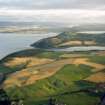
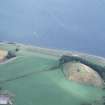
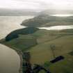
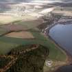
Castleton


Township (Period Unassigned)
Site Name Castleton
Classification Township (Period Unassigned)
Canmore ID 103847
Site Number NH65SE 37
NGR NH 6935 5378
NGR Description Centred on NH 6935 5378
Datum OSGB36 - NGR
Permalink http://canmore.org.uk/site/103847


- Council Highland
- Parish Avoch
- Former Region Highland
- Former District Ross And Cromarty
- Former County Ross And Cromarty
Note
A township, comprising five roofed buildings, one partially roofed building, three unroofed buildings of which one is L-shaped and has three compartments, and four enclosures is depicted on the 1st edition of the OS 6-inch map (Ross-shire 1881, sheet xc). Four roofed buildings and two enclosures are shown on the current edition of the OS 1:10000 map (1976).
Information from RCAHMS (AKK) 16 April 1996.

