
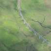
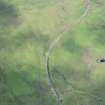
Rannoch Viaduct


Railway Viaduct (19th Century) - (20th Century)
Site Name Rannoch Viaduct
Classification Railway Viaduct (19th Century) - (20th Century)
Alternative Name(s) Rannoch Moor
Canmore ID 103542
Site Number NN45NW 3
NGR NN 4228 5824
NGR Description NN 4228 5824 to NN 4229 5842
Datum OSGB36 - NGR
Permalink http://canmore.org.uk/site/103542


- Council Perth And Kinross
- Parish Fortingall
- Former Region Tayside
- Former District Perth And Kinross
- Former County Perthshire
NN45NW 3 4228 5824 to 4229 5842
Viaduct [NAT]
OS 1:10,560 map, 1968.
This viaduct was built by Formans & McCall of Glasgow (engineers), Lucas & Aird of London (contractors) and Alexander Findlay & Co of Motherwell (steelworkers) to carry the West Highland Rly (a subsidiary of the North British Rly) across an old river-bed; it opened on 11 August 1894, and remains in use. It is of lattice girder type and is built partly on a curve of 12 chains radius. There are nine spans of 70 ft 6 ins (21.5m) within its 684 ft (209m) length and the piers of locally-quarried granite were founded on boulder clay.
M Smith 1994.

