Inveruglas Viaduct
Railway Viaduct (19th Century) - (20th Century)
Site Name Inveruglas Viaduct
Classification Railway Viaduct (19th Century) - (20th Century)
Alternative Name(s) Craigenarden Viaduct; Inveruglas Water
Canmore ID 103531
Site Number NN30NW 8
NGR NN 31739 09214
Datum OSGB36 - NGR
Permalink http://canmore.org.uk/site/103531
- Council Argyll And Bute
- Parish Arrochar
- Former Region Strathclyde
- Former District Dumbarton
- Former County Dunbartonshire
NN30NW 8 317 092
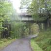
This viaduct was built by Formans & McCall of Glasgow (engineers) and Lucas & Aird of London (contractors) to carry the West Highland Rly (a subsidiary of the North British Rly) across the Inveruglas Water at a height of 54 ft (16.4m). It opened on 11 August 1894, and remains in use. It is built of blue whinstone with concrete arches and is the only arched viaduct on the line. There are eight spans of 36 ft (11m) in its 396 ft (121m) length and the parapets were crenellated for decorative effect.
M Smith 1994.
Field Visit (1 June 2011 - 1 December 2011)
Cultural Heritage assessment for the proposed Sloy Sub-Station Works. The assessment forms part of an Environmental Assessment, submitted in 2011. The Cultural Heritage assessment identifies all historic environment features within close proximity to the proposed works development area (through desk-based assessment and field survey). An assessment of the direct and indirect impacts of the development on these features is included.
Information from OASIS ID: cfaarcha1-182578 (H Gray) 2011


