
Pricing Change
New pricing for orders of material from this site will come into place shortly. Charges for supply of digital images, digitisation on demand, prints and licensing will be altered.
Upcoming Maintenance
Please be advised that this website will undergo scheduled maintenance on the following dates:
Thursday, 9 January: 11:00 AM - 3:00 PM
Thursday, 23 January: 11:00 AM - 3:00 PM
Thursday, 30 January: 11:00 AM - 3:00 PM
During these times, some functionality such as image purchasing may be temporarily unavailable. We apologise for any inconvenience this may cause.
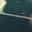
Unknown: Scapa Flow, Orkney


Obstruction(S) (Period Unknown)
Site Name Unknown: Scapa Flow, Orkney
Classification Obstruction(S) (Period Unknown)
Alternative Name(s) Calf Of Flotta; Foul
Canmore ID 102188
Site Number ND39NE 8025
NGR ND 37934 97399
NGR Description Centred ND 3793 9740
Datum WGS84 - Lat/Long
Permalink http://canmore.org.uk/site/102188


- Council Orkney Islands
- Parish Maritime - Orkney
- Former Region Orkney Islands Area
- Former District Maritime
- Former County Not Applicable
ND39NE 8025 centred 3793 9740
N58 51.595 W3 4.5633
NLO: Flotta [name: ND 37 94]
Calf of Flotta [name: ND 382 967]
Stromness [name: HY 253 090]
Scapa Flow [name centred HY 36 00].
For obstructions (possibly general debris of 'anchorage' type) within the area of this map sheet, see ND39NE 8001-18, 8020-1. 8024, 8026-31, 8033-8, 8041-4, 8057-61 and 8063.
'Wreckage'.
G Ridley 1992.
Quality of fix = EDM
Horizontal Datum = OGB
General water depth = 30
Surveying Details
-----------------------------
9 December 1977. Wreckage, within an area of fouls (or obstructions) 61 metres radius, is reported at 58 51 35.7N, 003 04 33.8W.
Hydrographic Office, 1995.
Reference (19 April 2012)
UKHO Identifier : 001041
Feature Class : Obstn
Obstruction Category : Foul ground
State : LIVE
Classification : Unclassified
Position (Lat/long) : 58.85992,-3.07606
Horizontal Datum : ORDNANCE SURVEY OF GREAT BRITAIN (1936)
WGS84 Position (Lat/long) : 58.85950,-3.07765
WGS84 Origin : 3-D Cartesian Shift (BW)
Position Method : Electronic Distance Measuring System
Position Quality : Precisely known
Depth Quality : Depth unknown
Water Depth : 30
Vertical Datum : Lowest Astronomical Tide
Name : Foul
Type : WRECKAGE
Contact Description : Notable debris
Original Sensor : Acoustic Sensor
Original Detection Year : 1977
Original Source : Other
Surveying Details : **9.12.77 WRECKAGE, FOUL AREA, 200FT RADIUS, SHOWN IN 585135.7N, 030433.8W ON HUNTING SURVEYS [K6864/17]. NC 2162.
Chart Symbol : FA
Charting Comments : CIRCULAR AREA, RADIUS 61MTRS
Date Last Amended : 04/04/2001

