
Grimsay, St Michael's Chapel


Burial Ground (Medieval), Chapel (Medieval)
Site Name Grimsay, St Michael's Chapel
Classification Burial Ground (Medieval), Chapel (Medieval)
Canmore ID 10193
Site Number NF85SE 1
NGR NF 88179 54809
Datum OSGB36 - NGR
Permalink http://canmore.org.uk/site/10193


- Council Western Isles
- Parish North Uist
- Former Region Western Isles Islands Area
- Former District Western Isles
- Former County Inverness-shire
NF58SE 1 8817 5480.
(NF 8817 5480) St Michael's Chapel (NR) (In Ruins)
OS 6" map, Inverness-shire, 2nd ed., (1904)
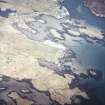
The ruins of St Michael's Chapel on Grimsay are on a small plateau on the highest point of a promontory. They are oblong, 23ft 2ins by 13ft 8ins, within walls 28 to 30ins thick. In 1915 the west gable was about 8ft height.
The chapel stands in an enclosure, 63ft by 54ft, 'evidently once serving as a graveyard but disused for many years'. (E Beveridge 1911) The foundations of the boundary wall are overgrown with grass.
The foundation of the chapel is attributed to Amie MacRuari (c.1350-90). About 150 yds to the north-east, A A Carmichael (1871) noted 'another chapel and burying ground upon another point of land jutting into, but only a few feet above the level of, the sea. There was hardly any traces of this chapel and I have hitherto failed even to ascertain the name.' Beveridge saw no remains.
A A Carmichael 1871; F W L Thomas 1890; E Beveridge 1911; RCAHMS 1928.
St Michael's Chapel and its surrounding enclosure are as described by the above authorities.
The north, south and east walls of the chapel are now only about 0.5m high.
There is no trace of the other chapel and burying ground mentioned by Carmichael.
Visited by OS (R D) 8 June 1965.
Field Visit (28 June 1915)
St Michael's Chapel, Kallin, Grimsay.
The ruins of St Michael's Chapel occupy a very prominent position on a small plateau on the highest point of the promontory at the southeast end of Grimsay, about 500 yards southeast of the school at Kallin. It has been built in a small enclosure, the foundations of the boundary wall, overgrown with grass, being traceable all round. It is an oblong structure of stone and lime, orientated [WNW to ESE], and measuring internally 23 feet 2 inches in length by 13 feet 8 inches in breadth. The walls, which are from 2 feet 4 inches t o 2 feet 6 inches thick, are reduced to a height of about 1 ½ feet, except the western gable, which stands 8 feet high, and a small part of the south wall, which is 3 feet in height on the inside. The positions of neither door nor windows can be detected. In the eastern end there is the foundation of some structure, but whether it is part of the altar or a grave cannot be determined.
On this church cf. Introd., p. xx. According to Captain Thomas in 1871 there was then ‘a splayed, straight -lined window . . . nearer to the north than the south side’ in what remained of the west wall. In the north wall, 9 feet high, were two windows, that to the east destroyed, that to the west being rectangular, ‘1 ½ feet on the outside, with parallel sides (4 ½ feet high) for ¾ foot, then splayed to 3 feet on the inside’ (1).
RCAHMS 1928, visited 28 June 1915.
OS map: North Uist xlv.
(1) Archaeologia Scotica, V., p. 244.

