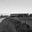
Kilrenny, Rennyhill Farm
Farmstead (19th Century)
Site Name Kilrenny, Rennyhill Farm
Classification Farmstead (19th Century)
Alternative Name(s) Kilrenny Mains
Canmore ID 100441
Site Number NO50SE 185
NGR NO 57277 04926
Datum OSGB36 - NGR
Permalink http://canmore.org.uk/site/100441
- Council Fife
- Parish Kilrenny
- Former Region Fife
- Former District North East Fife
- Former County Fife
NO50SE 185 57277 04926
NO50SE 44.00 57328 04876 Rennyhill House
Watching Brief (July 2000)
A watching-brief was conducted on behalf of George Gibson, Building Contractor for a house plot and associated features being constructed at Rennyhills Farm near Kilrenny, Fife.
The area of the watching brief lies adjacent to a right of way and a number of recorded sites, most notably the Skeith Stone at NO 5708/0464. The village of Kilrenny currently predominantly dates to the 18th century, though it was made a burgh of regality prior to 1672. It is possible that a settlement existed here in the 7th or 8th century, probably religious around the site of the present church at the East side of the village.
Stuart Farrell
July 2000


