
Following the launch of trove.scot in February 2025 we are now planning the retiral of some of our webservices. Canmore will be switched off on 24th June 2025. Information about the closure can be found on the HES website: Retiral of HES web services | Historic Environment Scotland
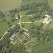
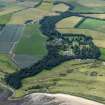
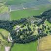
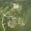
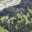
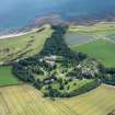
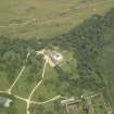
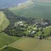
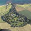
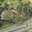
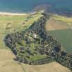
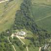
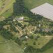
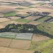
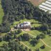
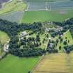
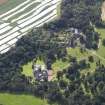
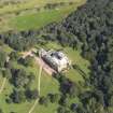
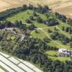
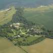
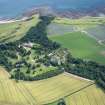
Cambo House


Country House (19th Century)
Site Name Cambo House
Classification Country House (19th Century)
Alternative Name(s) Cambo House Policies
Canmore ID 100293
Site Number NO61SW 20
NGR NO 60355 11481
Datum OSGB36 - NGR
Permalink http://canmore.org.uk/site/100293


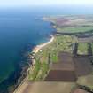
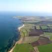
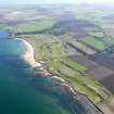

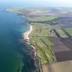
- Council Fife
- Parish Kingsbarns
- Former Region Fife
- Former District North East Fife
- Former County Fife
NO61SW 20.00 60355 11481
Cambo House [NAT]
OS (GIS) AIB, April 2008.
Location formerly entered as NO 60375 11478.
NO61SW 20.01 NO 60042 11030 Mausoleum
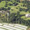
NO61SW 20.02 NO 60295 11237 Stables
NO61SW 20.03 NO 60358 11242 Bridge within Walled Garden
NO61SW 20.04 NO 60424 11480 Bridge
NO61SW 20.05 NO 60777 11656 Bridge
NO61SW 20.06 NO 60623 11592 Bridge
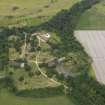
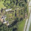
NO61SW 20.07 NO 60366 11273 Walled Garden
NO61SW 20.08 NO 60826 11686 Footbridge
NO61SW 20.09 NO 60809 11675 Estate Bridge
NO61SW 20.10 NO 60322 10942 Footbridge (East Newhall)
NO61SW 20.11 NO 60073 11268 Dovecot
NO61SW 20.12 NO 60163 11371 Curling Pond
NO61SW 20.13 NO 60349 11515 Cambo Garage House
NO61SW 20.14 NO 60337 11179 Footbridge (S of walled garden)
NO61SW 20.15 NO 60358 11263 Footbridge (within walled garden)
NO61SW 20.16 NO 60369 11301 Footbridge (within walled garden)
NO61SW 20.17 NO 60370 11314 Footbridge (immediately outside walled garden)
NO61SW 20.18 NO 60365 11221 Footbridge (S of walled garden)
See also:
NO51SE 35.00 NO 59626 11293 Cambo Farm
NO51SE 35.01 NO 59508 11303 Cambo Farm Cottages
NO51SE 35.02 NO 59779 11370 Cambo Farm Cottages
NO51SE 133 NO 59857 10629 North Lodge
NO51SE 134 NO 59881 10601 South Lodge
NO51SE 137 NO 59889 10530 Gamekeeper's Lodge
NO61SW 1 NO 6035 1148 Old House of Cambo
NO61SW 9 NO 6039 1175 and NO 6045 1166 Ring-ditches (within Cambo House policies)
NO61SW 14 NO 6013 1184 Ring-ditch and cropmarks (within Cambo House policies)
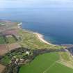
NO61SW 21 NO 60322 10731 East Newhall (Cambo House Visitor Centre)
NMRS REFERENCE:
Cambo House was burnt in 1878 and the current Cambo House was built in its place.
(Undated) information from Demolitions catalogue held in RCAHMS library.
See also Historic Scotland List Description HB No: 8759 for fuller architectural history of this building.
(Undated) information in NMRS.

