Following the launch of trove.scot in February 2025 we are now planning the retiral of some of our webservices. Canmore will be switched off on 24th June 2025. Information about the closure can be found on the HES website: Retiral of HES web services | Historic Environment Scotland
Field Visit


Date 15 May 2013 - 16 May 2013
Event ID 960323
Category Recording
Type Field Visit
Permalink http://canmore.org.uk/event/960323
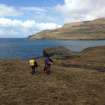
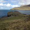
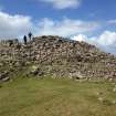
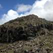
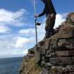
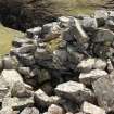
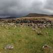
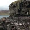
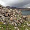
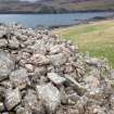
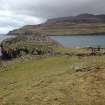
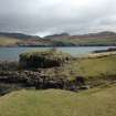
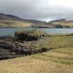
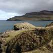
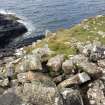
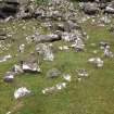
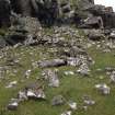
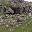
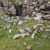
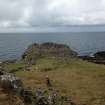
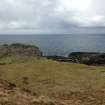
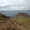
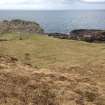
This dun is situated on the S side of the mouth of Loch Eynort, on a narrow coastal promontory that stands some 16m above the sea-level on the W but no more than 4m - 5m on the landward side A rounded triangle on plan, it measures a maximum of 18m from NNE to SSW by 16.6m from E to W within a stone wall up to 3.4m in thickness (but reducing to only 1.6m on the W) which stands to an external height of 2.5m on the SW and an internal height of 1.3m where best preserved. There is an entrance (1.5m wide) on the ESE in which a recently exposed door-check is visible. The interior of the dun is largely featureless. There are the faintest traces of a stony platform which may indicate the site of a structure: the purpose of a wall 2m in length, 1m in thickness and only one course high, which is set close to the dun wall on the S, is not known.
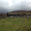
There is an additional line of defence, comprising a wall measuring at least 25m in length and about 3m in thickness, which is set downslope from and no more than about 2.5m - 3m from the inner wall on the landward (ESE) side. The inner face of this wall is completely obscured by rubble but the outer face, which stands up to 1m high, exhibits two phases of construction N of the entrance. Here, two outer wall-faces are visible, demonstrating that the structure has been reduced in thickness by 0.5m. The entrance through this wall measures 1.5m in width and is set slightly further to the N than the corresponding gap in the inner wall.
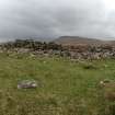
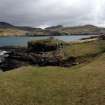
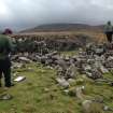
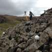
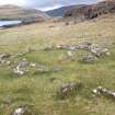
Evidence of later activity in the vicinity of the dun includes five huts which lie within 30m of it and two small conjoined pens which have been constructed against the outer face of the inner wall a little to the N of the entrance. The largest of the huts (NG 35494 23401) lies immediately E of the dun. Oval on plan, it measures 3.5m from N to S by 3.2m transversely within a low stone wall (0.8m thick) that probably represents the footing of a largely turf-built structure. The NE side of the hut appears to overlie a denuded wall, which defines the SW side of a plot of lazy-bed cultivation that is most probably associated with the nearby township of Laimhrig na Moine (NG32SE 15). A second hut (NG 35504 23403), close-by to the ENE, is set into and is therefore demonstrably later than one of the lazy-beds. The three other huts are situated at NG 35488 23402; NG 35480 23388 and NG 35477 23381 respectively. The prominent stone wall that runs from a point immediately S of the entrance through the outer wall of the dun ESE for a distance of about 33m, where it terminates against a steep rock-face, probably relates to a more recent period of stock control.
The site was surveyed by AOC Archaeology Ltd (15-16 May 2013).
Visited by RCAHMS (GFG) 15-16 May 2013.