Field Visit


Date 15 August 1943
Event ID 934700
Category Recording
Type Field Visit
Permalink http://canmore.org.uk/event/934700
Craig Phadrig is an isolated peak of conglomerate rising to just under 800ft; it forms the north east extremity of the ridge between the Ness Valley and the Beauly Firth that is continued beyond the [track] by the Hill of Kessock. The sides of the peak are steep and in places precipitous. The elongated summit is defended by two stony ramparts entirely covered with grass and whins; the outer one was still planted with trees when the site was visited. The trees on the inner rampart and in the interior had been felled. The inner rampart encloses an irregular rectilinear figure, running from the south east dead straight for about 250’ and on the north west for 220’ but not quite parallel since the width at the north east end is 90’ from crest to crest [but] at the south west only 80’. No vitrified masses are now exposed, but on the south west the track across the rampart has laid bare two or three stones of a built masonry face 20’ outside the apparent crest of the rampart. No visible gap interrupts the rampart.
The outer rampart is much more overgrown. It crosses the ridge 63’ from the inner rampart’s crest at the north east end and 73’ from it at the south west end, but on the steep sides approaches to within 45’ of the inner rampart.
The interior of the enclosure is some 4’ below the rampart crest, but is uneven and pitted with hollows filled with nettles and ferns.
Visited by RCAHMS (VGC, AG) 15 August 1943.
Sources: Tytler 1783, Wallace 1921
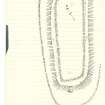
[Typescript: INV 21; Manuscript (2): 1943, 105 (sketch]