Field Visit
Date 17 July 1943
Event ID 931912
Category Recording
Type Field Visit
Permalink http://canmore.org.uk/event/931912
This monument is situated on the summit of Tillymuick, at an elevation of 834 feet above sea-level and of about 500 ft above the valley-bottom at Kirkton, half a mile away to the NW. The summit is so gently rounded that, in spite of the large size of the enclosure, its centre is but slightly higher than its perimeter. There is a modern cairn on the summit, and the compass-bearings given below have reference to this and not to the central point of the enclosure.
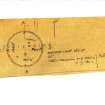
The enclosure proved too large for single-handed survey, but the 25” OS map shows that it is practically circular, measuring internally 550ft from N to S by 560ft E to W. The enclosing wall, or at least its foundations, are of stone, but it is now reduced for the most part to a low heather-covered mound up to 12ft in breadth. Only at one point, on the NE, does it stand as much as 2ft high externally; again only at one point can the true thickness be measured between exposures of the inner and outer faces – this on the SW, the thickness there being 9ft. There is no ditch, and the stones must therefore presumably have been gathered on the surface; their size suggests a very solid type of masonry. There are three gaps in the wall, all of which may have been entrance4s, but none of which can be positively identified as such; one on the W and another on the SE are 5ft to 6ft in breadth, while the third, which occurs on the SW at a shallow swampy hollow, is 12ft broad. On the NNW a fairly modern track breaks through the line of the wall; this is no doubt connected with the working of some small quarries and the collection of loose stones from the surface – indeed, the poor preservation of the wall is probably e to be attributed in large measure to stone-robbers. Further evidence of these activities is to be seen in the virtual disappearance of the wall in part of the N sector; in the small piles of stone, evidently quite modern, that have been prepared for removal; in the hollows from which large stones have been extracted; and in the clearance of superficial; stones, otherwise very plentiful, from parts of the enclosures area and of the hillside without.
The enclosure contains a number of hut-circles, perhaps up to two dozen, but no count was possible as the ground was much obscured by a heavy growth of heather. No doubt many more details would appear if the heather was burnt. The largest hut noted was on the extreme summit, just W of the modern cairn; this one is round, and measures 25ft in diameter. The best-preserved one is with others in a group, SW of the cairn; it measures 16ft in diameter, and shows stones as well as turf in its foundations. There is another group on the W, averaging about 15ft in diameter and partly dug back into the slope to bring their floors to a level. In addition to the hut-circles three small cairns, of the type usually believed to represent collections of field stones, were observed N of the cairn; whatever be the origin of these particular cairns, it is worth noting any attempts that may have been made in ancient times to clear this especially stony area were comparatively ineffective seeing that, in spite of further recent clearance that has been described above, a great part of the enclosure is still much too heavily encumbered for cultivation.
Visited by RCAHMS (AG) 17 July 1943.
(OS xliv SE ‘Earthwork and Tumuli’)


