Pricing Change
New pricing for orders of material from this site will come into place shortly. Charges for supply of digital images, digitisation on demand, prints and licensing will be altered.
Excavation
Date 1995 - 1996
Event ID 552648
Category Recording
Type Excavation
Permalink http://canmore.org.uk/event/552648
Excavation of a cropmark site at Littleour.
NO 174 403. As part of the Cleaven Dyke project, a reconnaisance excavation was undertaken on this cropmark site. The site was published by RCAHMS (RCAHMS 1994). It appears on aerial photographs as two roughly parallel lines of pits with a curved terminal formaed by two further pits. There is a larger internal pit on the axis of the structure near the E end. There are hints on the photographs of another end of similar form, but possibly slightly wider; however, this area is obscured by the proximity of a field boundary. Geophysical survey suggests that there is another axial pit at the W end.
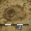
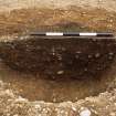
An area 9m by 12m was cleaned and examined. Eight features were identifiable as massive post holes, 0.7m to 0.9m across. Seven were excavated, the deepest was 0.9m and the shallowest 0.5m. These had formed the lines seen on the aerial photographs. The ninth was the axial pit, which measured 1.7-1.8 in diameter and a maximum of 0.65m deep. Its fills were confused, they seem best interpreted as the disrupted remains of a pit originally containing a massive post. All nine features, in particular the axial pit, contained evidence of burning.
There are at least three comparable structures in Perthshire - two nearby at Upper Gothens (NO14SE 85) and Carsie Mains (RCAHMS 1994). If Littleour is double-ended in the same way as the first of these, with a second axial post near the other end, then one interpretation of the currently available evidence is as a massive roofed building. The overall size could be 8-9m by 22-23m; this can be compared with the Neolithic building at Balbridie (24m by 12m) (NO79NW 16). Radiocarbon dating is in hand.
Sponsors: British Academy, Russell Trust, Society of Antiquries of Scotland, Society of Antiquaries of London, Historic Scotland
G J Barclay and G S Maxwell 1995
NO 174 403 The excavation of the rectilinear enclosure at Littleour was completed in this, the second, season of excavation (Barclay and Maxwell 1995). The enclosure, oriented E-W, measured 22m long by 7m (E end) to 8m (W) broad. Both sides of the enclosure consisted of eight post-holes between 2.5-3m apart; the post-holes were between c 0.7-1.1m across and 0.5-1m deep. The two rounded ends of the enclosure were formed by a pair of posts of similar dimensions. The holes appear to have held posts between 0.4-0.5m in diameter. The structure showed signs of burning.
There were two features within the interior of the structure. The first was a large pit (excavated in 1995), situated on the major axis of the structure near its E end. This has been interpreted as the hole for a massive post which has fallen while it or material around it was burning. One radiocarbon determination from the 1995 season is so far available, from oak charcoal from this feature: 4640+/-60 bp uncal (GU-4379). The calibrated range at 2s is 3622-3111 cal BC. The second feature was a small pit near the N side of the structure, in the W half. The pit contained portions of at least four Grooved Ware vessels (two of them with encrustations of what appear to be organic residues adhering- assessment of these is underway) and a number of fine flint artefacts. It is hoped that radiocarbon dating of the residues will be possible.
There were two further features, both outside the enclosure. At the W end was a further massive post-hole. This could have been part of an offset entrance feature to the enclosure. In a roughly opposed position at the E end was a shallow feature whose purpose could not be determined.
It is unlikely that the structure was roofed. It would appear to have been a simple timber enclosure, possibly with a larger free-standing post near the E end. An interpretation as a ceremonial monument seems unavoidable. The deposition of Grooved Ware and flint in the only other pit in the enclosure can hardly be fortuitous, but surely an indication of the site's continuing association with ceremonial practices into the later Neolithic.
The area of the structure and the field around has been examined by Stirling University Environmental Science Department, in a pilot project for their work on assessing the rate of soil erosion from archaeological sites. A pollen column, to provide an environmental context for the Littleour site and the Cleaven Dyke (Barclay and Maxwell 1995) has been analysed by St Andrews University Geography Department. All this work will be reported upon in the final publication.
Sponsors: British Academy, Society of Antiquaries of Scotland, Russell Trust, Historic Scotland
G J Barclay and G S Maxwell 1996


