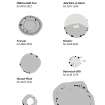
Measured Survey
Date 28 March 2000
Event ID 1153867
Category Recording
Type Measured Survey
Permalink http://canmore.org.uk/event/1153867
RCAHMS surveyed Sands of Forvie ring-cairn on 28 March 2000 with plane table and alidade producing a plan and sections at a scale of 1:100. The plan was reproduced in graphics vector software and published at 1:500 (RCAHMS 2007, fig. 5.8).
The plan and one of the sections were subsequently used as the basis for an illustration, produced in ink and finished in vector graphics software, that was published at a scale of 1:250 (Welfare 2011, 539).


