Measured Survey


Date 30 June 2004
Event ID 1152116
Category Recording
Type Measured Survey
Permalink http://canmore.org.uk/event/1152116
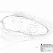
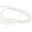
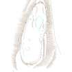
RCAHMS surveyed the fort at Garrywhin on 30 June 2004 with plane table and self-reducing alidade at a scale of 1:500. The plan was later redrawn in vector graphics software, with illustrations produced at scales of 1:500 and 1:1000.