Accessibility

Font Size

100% 150% 200%

Background Colour

Default Contrast
Close Reset

Measured Survey

Date 29 March 1994

Event ID 1149843

Category Recording

Type Measured Survey

Permalink http://canmore.org.uk/event/1149843

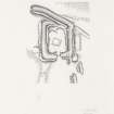
RCAHMS surveyed the Roman fortlet at Burnswark on 29 March 1994 with plane-table and self-reducing alidade at a scale of 1:500. The plan was redrawn in ink and published at a scale of 1:1000 (RCAHMS 1997, Fig. 194).

People and Organisations

Digital Images

Publication illustration; Plan of Burnswark Roman fortlet.
Publication illustration; Plan of Burnswark Roman fortlet.Survey drawing; Burnswalk Roman fortlet.Publication drawing; Plan of Burnswark Roman fortlet. 
Publication drawing; Plan of Burnswark Roman fortlet.

References