Measured Survey


Date 23 October 1990
Event ID 1148745
Category Recording
Type Measured Survey
Permalink http://canmore.org.uk/event/1148745
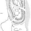
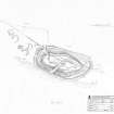
RCAHMS surveyed the fort at Beattock Hill on 23 October 1990 with plane-table and self-reducing alidade at a scale of 1:500. The plan was redrawn in ink and published at a scale of 1:1000 (RCAHMS 1997, Fig. 59).