Pricing Change
New pricing for orders of material from this site will come into place shortly. Charges for supply of digital images, digitisation on demand, prints and licensing will be altered.
Survey of the Antiquities on Eilean an Naoimh
Date 1927
Event ID 1145891
Category Project
Type Project
Permalink http://canmore.org.uk/event/1145891
The Eileach an Naoimh is the southernmost of a group of islets known as the Garvellachs, or Isles of the Sea, which lie in the mouth of the Firth of Lorne, between Mull in the north and Scarba on the south. Now entirely uninhabited, these islands are inaccessible, not so much from their remoteness as from the fact that they are exposed to the full force of the Atlantic gales which sweep up from the west, often with great suddenness, and the huge seas which break on their rocky shores make a landing impossible. The strong tidal currents also render their neighbourhood dangerous to mariners.
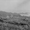
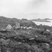
Low on the eastern side, the islands rise to the west, and then drop sheer into the Atlantic in stupendous cliffs over two hundred feet in height. The eastern coasts are thickly beset with skerries whose black fangs spouting with ceaseless breakers warn sailing yachts of the danger of approach. On the landward side of the Eileach an Naoimh several narrow creeks indent the rocky shores and permit of access by small boats in calm weather. The usual landing-place (Fig. 1) is a long narrow inlet called Geodha Chaluim Chille, at the head of which is Columba's Well.
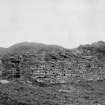
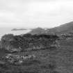
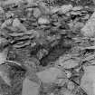
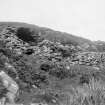
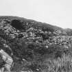
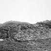
Notwithstanding the stormy and dangerous waters by which it is surrounded, the island was in ancient times the site of a chapel and some sort of ecclesiastical settlement, the remains of which have been happily preserved just because of its inaccessibility. Besides the early chapel there are still extant a beehive hut, an underground cell fancifully called 'the prison’, and various buildings commonly termed the 'monastery’, the 'abbot's house' and the 'hospitium' respectively - a kiln or oast- house and two graveyards, the whole forming a group of structures of much archaeological interest. It was to make an intimate study of these antiquities on behalf of the Society that an expedition was planned and successfully accomplished in the summer of 1927.
The expedition was rendered possible owing to the very kind offices the Rev. Herbert Reid, M.A., M.C., of Port-Glasgow, who generously placed his motor yacht, the Colleen, at the disposal of the exploring party, and conveyed them in person to and from Cullipool in the of Luing. A spell of good weather enabled the skipper to land us, and what was more important, to safely re-embark us on five successive days. We also owed much to Mr. Mackenzie of Cullipool, Chairman of the Parish Council of Luing, who accompanied the party, and whose knowledge of tides and hidden rocks and landing-places was invaluable.
The party consisted of Professor T. H. Bryce, F.R.S., the President of the Society, Rev. G. A. Frank Knight, D.D., F.R.S.E., Mr. C. Calder of the Ancient Monuments Commission [RCAHMS], and Rev. Campbell M. Macleroy, B.D.
Permission for the investigations had been obtained a year earlier from the proprietor, Col. Gascoigne of Craigņish Castle, but when expedition came to be organised it transpired that the structures had been scheduled under the Ancient Monuments Act and our investigations were restricted by the Authorities to a surface examination within scheduled area. The main object then became the obtaining of detailed and accurate plans of the structures. To this end an arrangement come to with the Ancient Monuments Commission in accordance with which they sent one of their staff of investigators, Mr. C. S. T. Calder, to accompany the party, and to prepare a report with plans of the buildings in anticipation of a future inventory of these islands. The expedition was thus made to fulfill a double purpose. The Commission were enabled to compile the inventory of the Ancient Monuments, and they have kindly permitted us to use the plans for the illustration of this paper. We engaged some workmen from the slate quarries at Cullipool and by their aid we removed the bracken and other vegetation in which most of the ruins were largely hidden, and were thus able, without disturbing the surface, to reveal the structures sufficiently to obtain a better idea of their nature, and to permit of Mr. Calder making accurate and complete plans of all of them.
Mr. George Knight, son of Dr. Knight, gave valuable assistance to Mr. Calder in his triangulation of the site, and he and Mrs Macleroy, who also accompanied the party, took many excellent photographic views.


