Pricing Change
New pricing for orders of material from this site will come into place shortly. Charges for supply of digital images, digitisation on demand, prints and licensing will be altered.
Nether Abington Motte and Bailey Special Survey
Date 6 February 2015
Event ID 1129148
Category Recording
Type Field Visit
Permalink http://canmore.org.uk/event/1129148
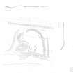
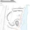
This motte and bailey castle is situated on the W bank of the River Clyde, wedged between the river and the public road to Edinburgh (A702), which has encroached upon its ditch to the W. The motte has been raised on a river terrace in which stone outcrops and, in consequence, has an unusual, sub-triangular shape on plan that narrows to a point on the S. It measures 28m from N to S by 20m transversely at its widest point and stands to 2m in height above the bailey. The top of the motte is 22m by 11m in extent. It is surrounded by a ditch 10m in breadth by up to 2m in depth, the contents of which have presumably been used to raise the motte. There is a slight dip in the WNW of the motte, which may mark the site of an entrance. However, a slight bank along its edges and other minor features on top of the motte may be a relic of the construction of a monument to a local fisherman that has been raised in the centre of the motte, or the excavations that took place in the 19th century (see below).
The bailey, which extends some 70m from N to S by 60m transversely, is enclosed by an earthen rampart 5m in breadth and up to 1.5m in height with a outer ditch about 10m in width that broadens and deepens from nothing on the W to more than 2m as it nears the river on the S due to erosion by the stream course that drains the marshy ground to the W. The original entrance is in the SW, marked by a gap in the rampart that has in-turned terminals; a second gap in the bank on the NNW has been made by a track. Where the rampart meets the ditch around the motte it has been turned in to limit access.
There is a possible turf building in the bailey that sits on the edge of the river terrace and measures 18m from E to W by 5m transversely overall, and there is a short length of a shallow ditch parallel to it on the S near the ditch of the motte. A small platform has been cut into the back of the rampart on the NW and there is a hollow in the S part of the bailey, sub-divided by a N-S terrace, possibly due to quarrying.
Excavations in the 19th century by Irving found a charcoal and animal bone spread, presumably a midden, 6 feet down in the middle of the motte, presumably on the old ground surface (Irving and Murray, I, 27-8). No direct documentation for the castle has been found, but John of Crauford, who was witness to a charter of lands in Lesmahago to Kelso Abbey between 1147 and 1164 (OPS I, 160-1) may be the lord of the estate in the mid-12th century that gave his name to the parish, and he or his descendants may have been responsible for the construction of the motte.
Visited by RCAHMS (PD, WW, AMcC) 6 February 2015


