Pricing Change
New pricing for orders of material from this site will come into place shortly. Charges for supply of digital images, digitisation on demand, prints and licensing will be altered.
Field Visit


Date 27 April 1921
Event ID 1114491
Category Recording
Type Field Visit
Permalink http://canmore.org.uk/event/1114491
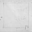
Cousland Castle (?).
In the high upland village of Cousland are some remains which are noticed as follows in the Statistical Account (ix, 281): ‘On the south side of this village, are to be seen the ruins of some buildings, with two enclosures surrounded by high walls. No authentic account of them, after much research, can be found; but if we may credit tradition, they are the remains of a nunnery. The highest wall, commonly called the White Dike, at present measures 24 feet, and the rest vary in height from 5 to 11. The inclosures were undoubtedly orchards, since cherry trees and gooseberry bushes were still growing a few years ago. That there was a churchyard here, and a bell to be seen hanging in the end of the chapel, till it was carried off by some tinkers, are facts supported by the testimony of persons still alive. Hence it is probable, that it was a religious foundation, and perhaps dedicated to St Bartholomew, since there are some acres of ground to the southward. which retain the name of Bartholomew's Firlot’.
The remains now form an enclosure, 224 feet square within walls 2 feet 10 inches thick, which stands complete to a height of 24 feet, at the north-west angle only. This enclosure was undoubtedly a garden or orchard, and the masonry suggests 17th century work. At the north-east corner is a very ruinous late 16th-century house of which the part that projects within the enclosure appears to be earlier than the portion lying parallel to and incorporated in the east wall. This older portion is a structure 30 feet wide and of indeterminate length and height. Its basement was ceiled with a barrel-vault, beneath which, at springing level, was a timber floor with joists borne on massive corbels 11 inches wide and high, that project 8 inches from the wall face. The upper chamber had at least one window, which was centred in the west gable. The lower chamber was the kitchen; of its great fireplace very little is left, and the spring of its arch can just be traced; its position is unusual, as it lies in the north lateral wall. In the surviving jamb of the fireplace is an inlet for water, with the external orifice 6 feet above the present ground-level and the inner opening breast-high. The channel, 8 inches wide, contracts to 2 ½ inches at the mouth. West of the jamb is a slop outlet. The kitchen has two small aumbries in the gable and two small windows looking southwards into the enclosure. The entrance lies in the south wall immediately south of the enclosure, and of it one jamb remains; its margin is chamfered and is rebated in rear for two doors, both opening inwardly. The inner was secured by a drawbar. What appears to be an addition to this structure can be traced in the east wall of the enclosure. It had a length of 79 1/3 feet, but height, width, and arrangement are indeterminate. Against the north wall of the enclosure, towards the western end, are several ruinous structures; these are secondary.
The older portion of the house is certainly orientated, but in no other particular does the structure suggest an ecclesiastical purpose; the remains are therefore probably those of Cousland Castle, which is indicated on diagrams of the Battle of Pinkie in Patten's 'Expedicion into Scotlande'.
HISTORICAL NOTE. Cousland belonged to the St. Clairs of Roslin (1). But in 1656 Robert MacGill, son of Sir James MacGill of Cranston Riddell, was returned heir to his brother in the lands and barony of Cousland (2).
RCAHMS 1929, visited 27 April 1921.
(1) Cf. Reg. Mag. Sig. (1542), No. 2769; (2) Inquis. Spec., Edinb., No. 1057.
OS Map: viii N.E. (unnoted)