Following the launch of trove.scot in February 2025 we are now planning the retiral of some of our webservices. Canmore will be switched off on 24th June 2025. Information about the closure can be found on the HES website: Retiral of HES web services | Historic Environment Scotland
Field Visit
Date 22 June 1925
Event ID 1098207
Category Recording
Type Field Visit
Permalink http://canmore.org.uk/event/1098207
5. Fort, Clatchard Craig.
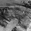
This fort, which overlooks the ruined Abbey of Lindores and commands a view over a wide stretch of the Tay valley, lies on the crest of a high rocky precipice, 300 feet above sea-level and about one mile south-east of the town of Newburgh. It may be roughly described as oval or, rather, kidney-shaped on plan, and the surface within the ramparts is rocky and uneven.
The fort is remarkable for the extent and complicated character of its defences, skilfully arranged on the slopes of all sides save the north, where nature had provided sufficient protection. The total area measures approximately 555 by 340 feet, and the immense amount of labour bestowed on the lay-out suggests that, like the great fort on Norman's Law (NO32SW 22) in the adjoining parish of Dunbog, this had been a place of more than ordinary importance. In detail, however, there is little or no resemblance between the two. Here the summit is occupied by an inner enclosure which is bounded on the north by the precipitous face of the hill and on the south by a rampart-now low but with a spread of about 9 or 10 feet running along the edge of a steep scarp 15 feet high. Farther down, a second rampart, abutting at either end on the precipitous face, and having a deep bend outwards on the south-west, swings round the hill to form an outer enclosure. Within the latter, at the north-west corner, is a rocky depression known as "The Bluidy Well", and in rear of the rampart about the middle of its length, where it is for a short distance somewhat narrower and lower, there is a curious hollow, as shown on the plan. The two enclosures probably represent the areas of occupation, the outworks being purely defensive. The precise disposition of these can best be understood from the plan. Generally, however, they may be described as consisting of five more or less complete lines of rampart, adapted to the configuration of the ground and separated from one another by intervals of varying width.
The ramparts are apparently of earth and stone. In one of them, at a depth of 1 foot to 1 foot 6 inches from the surface, there were observed the charred or decayed remains of beams, lying horizontally but pointing in various directions. The position of these (which may be the relics of a palisade) is marked on the plan. The entrance has been on the south, where there is a noticeable, though gradual, turning-in of the defences on both sides of a distinct break, 38 feet wide, in the outer of the two main lines. The gap is not, however, so clearly defined in the inner line, but this is definitely reduced in height for a space corresponding to the break in the outer line.
RCAHMS 1933, visited 22 June 1925.


