
2019 HES Aerial Survey (UAV)


Date 2019
Event ID 1047106
Category Project
Type Project
Permalink http://canmore.org.uk/event/1047106
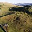
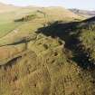
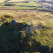
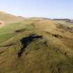
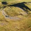
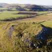
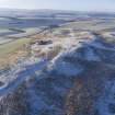
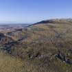
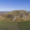
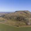
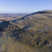
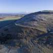
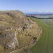
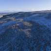
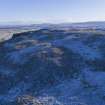
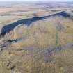
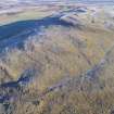
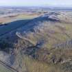
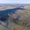
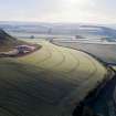
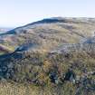
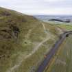
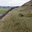
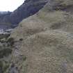
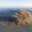
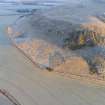
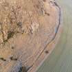
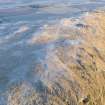
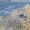
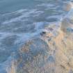
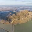
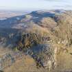
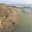
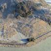
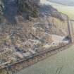
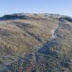
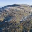
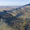
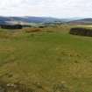
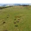
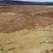
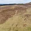
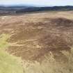
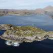
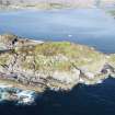
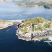
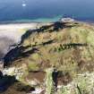
HES undertook a series of 15 UAV (drone) sorties in 2019 at a range of archaeological sites across Scotland. Flights were in general undertake to capture oblique aerial photographs that would enhance the record of particular sites or landscapes, and support other HES recording projects. Approximately 12 hours were spent airborne and a total of more than 1000 images and 10 videos were captured documenting about 80 archaeological sites. Images for 3D modelling with ground control points were captured at three sites, and a further two sites were surveyed with GNSS control. Each of the images and videos has been catalogued and the flight records are available on request. Flights were undertaken with a DJI Phantom 4 Pro and a DJI Inspire 2 mounted with an X7 camera and a 16mm lens.
Information from HES (GFG) 24 March 2020.

| Event | Type | Subtype | Notes | Date |
|---|---|---|---|---|
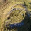
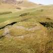
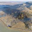
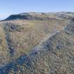
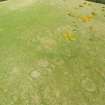
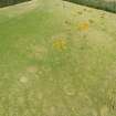
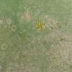
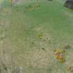
| 1111364 | RECORDING | MEASURED SURVEY | HES Survey and Recording undertook a UAV survey of Garbeg cairns on 13 May 2019. The survey consisted of the capture of 27 oblique and 96 vertical aerial photographs, and 2 video clips. Imagery was captured from a DJI Inspire 2 UAV with an X7 Zenmuse camera. [...] | 13 May 2019 |

DP 285265
Oblique aerial view
Historic Environment Scotland
17/1/2019
© Crown Copyright: HES

DP 285266
Oblique aerial view
Historic Environment Scotland
17/1/2019
© Crown Copyright: HES

DP 285267
Oblique aerial view
Historic Environment Scotland
17/1/2019
© Crown Copyright: HES

DP 285268
Oblique aerial view
Historic Environment Scotland
17/1/2019
© Crown Copyright: HES

DP 285269
Oblique aerial view
Historic Environment Scotland
17/1/2019
© Crown Copyright: HES

DP 285270
Oblique aerial view
Historic Environment Scotland
17/1/2019
© Crown Copyright: HES

DP 285271
Oblique aerial view
Historic Environment Scotland
17/1/2019
© Crown Copyright: HES

DP 285272
Oblique aerial view
Historic Environment Scotland
17/1/2019
© Crown Copyright: HES

DP 285273
Oblique aerial view
Historic Environment Scotland
17/1/2019
© Crown Copyright: HES

DP 285274
Oblique aerial view
Historic Environment Scotland
17/1/2019
© Crown Copyright: HES

DP 285275
Oblique aerial view
Historic Environment Scotland
17/1/2019
© Crown Copyright: HES

DP 285490
Oblique aerial view
Historic Environment Scotland
24/1/2019
© Copyright: HES

DP 285491
Oblique aerial view
Historic Environment Scotland
24/1/2019
© Copyright: HES

DP 285492
Oblique aerial view
Historic Environment Scotland
24/1/2019
© Copyright: HES

DP 285493
Oblique aerial view
Historic Environment Scotland
24/1/2019
© Copyright: HES

DP 285498
Oblique aerial view
Historic Environment Scotland
24/1/2019
© Copyright: HES

DP 285499
Oblique aerial view
Historic Environment Scotland
24/1/2019
© Copyright: HES

DP 285553
Oblique aerial view
Historic Environment Scotland
24/1/2019
© Copyright: HES


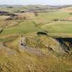
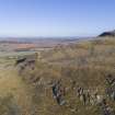
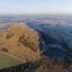
DP 285592
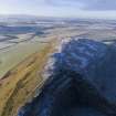
Obique aerial view. Entrances to Traprain Law fort.
Historic Environment Scotland
1/2/2019
© Copyright: HES

DP 285883
Oblique aerial view
Historic Environment Scotland
24/1/2019
© Copyright: HES

DP 285884
Oblique aerial view
Historic Environment Scotland
24/1/2019
© Copyright: HES

DP 285885
Oblique aerial view
Historic Environment Scotland
24/1/2019
© Copyright: HES

DP 285886
Oblique aerial view
Historic Environment Scotland
24/1/2019
© Copyright: HES

DP 285887
Oblique aerial view
Historic Environment Scotland
24/1/2019
© Copyright: HES

DP 285888
Oblique aerial view
Historic Environment Scotland
24/1/2019
© Copyright: HES

DP 285889
Oblique aerial view
Historic Environment Scotland
24/1/2019
© Copyright: HES

DP 285890
Oblique aerial view
Historic Environment Scotland
24/1/2019
© Copyright: HES

DP 285946
Oblique aerial view
Historic Environment Scotland
24/1/2019
© Copyright: HES

DP 285947
Oblique aerial view
Historic Environment Scotland
24/1/2019
© Copyright: HES

DP 285948
Oblique aerial view
Historic Environment Scotland
24/1/2019
© Copyright: HES

DP 285949
Oblique aerial view
Historic Environment Scotland
24/1/2019
© Copyright: HES

DP 285950
Oblique aerial view
Historic Environment Scotland
24/1/2019
© Copyright: HES

DP 285951
Oblique aerial view
Historic Environment Scotland
24/1/2019
© Copyright: HES

DP 285952
Oblique aerial view
Historic Environment Scotland
24/1/2019
© Copyright: HES

DP 285953
Oblique aerial view
Historic Environment Scotland
24/1/2019
© Copyright: HES

DP 285954
Oblique aerial view
Historic Environment Scotland
24/1/2019
© Copyright: HES

DP 285955
Oblique aerial view
Historic Environment Scotland
24/1/2019
© Copyright: HES

DP 285956
Oblique aerial view
Historic Environment Scotland
24/1/2019
© Copyright: HES

DP 285957
Oblique aerial view
Historic Environment Scotland
24/1/2019
© Copyright: HES

DP 285958
Oblique aerial view
Historic Environment Scotland
24/1/2019
© Copyright: HES

DP 285959
Oblique aerial view
Historic Environment Scotland
24/1/2019
© Copyright: HES

DP 285960
Oblique aerial view
Historic Environment Scotland
24/1/2019
© Copyright: HES

DP 285961
Oblique aerial view
Historic Environment Scotland
24/1/2019
© Copyright: HES

DP 285962
Oblique aerial view
Historic Environment Scotland
24/1/2019
© Copyright: HES


DP 293989
Oblique aerial view
Historic Environment Scotland
13/5/2019
© Copyright: HES

DP 293990
Oblique aerial view
Historic Environment Scotland
13/5/2019
© Copyright: HES

DP 293991
Oblique aerial view
Historic Environment Scotland
13/5/2019
© Copyright: HES

DP 293992
Oblique aerial view
Historic Environment Scotland
13/5/2019
© Copyright: HES

DP 293993
Oblique aerial view
Historic Environment Scotland
13/5/2019
© Copyright: HES

DP 293994
Oblique aerial view
Historic Environment Scotland
13/5/2019
© Copyright: HES

DP 293995
Oblique aerial view
Historic Environment Scotland
13/5/2019
© Copyright: HES

DP 293996
Oblique aerial view
Historic Environment Scotland
13/5/2019
© Copyright: HES

DP 293997
Oblique aerial view
Historic Environment Scotland
13/5/2019
© Copyright: HES

DP 293998
Oblique aerial view
Historic Environment Scotland
13/5/2019
© Copyright: HES

DP 293999
Oblique aerial view
Historic Environment Scotland
13/5/2019
© Copyright: HES

DP 294000
Oblique aerial view
Historic Environment Scotland
13/5/2019
© Copyright: HES

DP 294001
Oblique aerial view
Historic Environment Scotland
13/5/2019
© Copyright: HES

DP 294002
Oblique aerial view
Historic Environment Scotland
13/5/2019
© Copyright: HES

DP 294003
Oblique aerial view
Historic Environment Scotland
13/5/2019
© Copyright: HES

DP 294004
Oblique aerial view
Historic Environment Scotland
13/5/2019
© Copyright: HES

DP 294005
Oblique aerial view
Historic Environment Scotland
13/5/2019
© Copyright: HES

DP 294006
Oblique aerial view
Historic Environment Scotland
13/5/2019
© Copyright: HES

DP 294007
Oblique aerial view
Historic Environment Scotland
13/5/2019
© Copyright: HES


First 100 images shown.
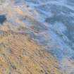
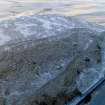
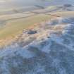
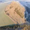
UAV photographs and video captured in 2019
UAV Sortie 2019/1
UAV Sortie 2019/9
