Following the launch of trove.scot in February 2025 we are now planning the retiral of some of our webservices. Canmore will be switched off on 24th June 2025. Information about the closure can be found on the HES website: Retiral of HES web services | Historic Environment Scotland
Date 16 November 2015 - 8 December 2015
Event ID 1032865
Category Recording
Type Archaeological Evaluation
Permalink http://canmore.org.uk/event/1032865
AOC Archaeology Group was commissioned by Historic Environment Scotland (HES) to undertake an exterior measured survey and an archaeological evaluation at the site of the ruined Charlestown Limekilns, Charlestown, Fife, to create a basic understanding of the remains as part of a wider scope of any future conservation works. These works were undertaken in November - December 2015. AOC were then further commissioned to undertake an interior survey of the kilns to complete the record, and these works were undertaken in July 2016.
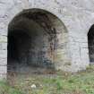
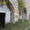
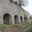
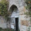
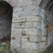
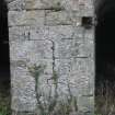
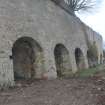
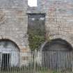
The limekilns were once part of a much wider operation dating as far back as the late 18th century to become one of the largest limeworks in the country by the 19th century. They now survive as ruins, albeit largely accessible, consisting of an array of 14 stone-built limekilns facing the harbour at Charlestown. The measured survey, undertaken using a Faro 3D laser scanner, has created 2D exterior plans, elevations and sections of the limekilns as well as some rendered orthographic images of the meshed laser scan data to display the results of the survey in a more accessible way. The suvey identified a number of features associated with how the limekilns would have originally been laid out and worked, including blocked drawholes, voids in the stonework, fixtures attached to the walls, earlier layers of render and roof scars. A topographic survey of the kilnhead was also undertaken to identify what remained of any features in this area. Although very heavily overgrown - especially to the north side - various mounds, enclosures and platforms were located, together with evidence showing the tops of some of the kiln shafts to the west side, although many were filled-in in the 1950s.
In addition to the exterior measured survey, three archaeological trenches were excavated in front of the limekilns and adjacent to Harbour Road which revealed a limited number of features relating to the operation of the limekilns during the 19th and 20th centuries. Several deposits of crushed quiklime were exposed which appeared to form a series of floors or hard standing. In addition, two concrete sleeper settings were identified associated with the rail transportation of the lime from the kiln openings to the docks. A brick and concrete foundation was also recorded to the east side of the limekilns, which are either the probable remains of the coke kilns shown on the Ordnance Survey map of 1856 or the brick buildings shown on the later Ordnance Survey map of 1896. No small finds relating to the workings of the limekilns were found.
The results of these on site works have been combined with some detailed archive research on the history of the limekilns to place the findings in context and to create a discussion on the interpretation of the features identified.
Information from AOC Archaeology Group
OASIS ID: aocarcha1-234160
Ordnance Survey licence number AC0000807262. All rights reserved.
Canmore Disclaimer.
© Bluesky International Limited 2025.
|
Charlestown, Harbour Road, Limekilns
Lime Kiln(S) (18th Century), Lime Works (18th Century)
Canmore ID 49497 |
|

DP 340113
Historic building recording, General view of central entrance through to rear corridor providing access to Kilns 1-10, E elevation, E bank, Limekilns, Harbour Road, Charlestown
Records of AOC Archaeology Group, archaeologists, Loanhead, Midlothian, Scotland
16/11/2015
© Copyright: AOC Archaeology Group. Courtesy of HES.

DP 340114
Historic building recording, General view of central entrance through to rear corridor providing access to Kilns 1-10, E elevation, E bank, Limekilns, Harbour Road, Charlestown
Records of AOC Archaeology Group, archaeologists, Loanhead, Midlothian, Scotland
16/11/2015
© Copyright: AOC Archaeology Group. Courtesy of HES.

DP 340115
Historic building recording, General view of central entrance through to rear corridor providing access to Kilns 1-10, E elevation, E bank, Limekilns, Harbour Road, Charlestown
Records of AOC Archaeology Group, archaeologists, Loanhead, Midlothian, Scotland
16/11/2015
© Copyright: AOC Archaeology Group. Courtesy of HES.

DP 340003
Historic building recording, Detail of entrance to Kiln 9, S elevation, E bank, Limekilns, Harbour Road, Charlestown
Records of AOC Archaeology Group, archaeologists, Loanhead, Midlothian, Scotland
16/11/2015
© Copyright: AOC Archaeology Group. Courtesy of HES.

DP 340004
Historic building recording, Detail of entrance to Kiln 9, S elevation, E bank, Limekilns, Harbour Road, Charlestown
Records of AOC Archaeology Group, archaeologists, Loanhead, Midlothian, Scotland
16/11/2015
© Copyright: AOC Archaeology Group. Courtesy of HES.

DP 340005
Historic building recording, Detail of entrance to Kilns 8 and 9, S elevation, E bank, Limekilns, Harbour Road, Charlestown
Records of AOC Archaeology Group, archaeologists, Loanhead, Midlothian, Scotland
16/11/2015
© Copyright: AOC Archaeology Group. Courtesy of HES.

DP 340006
Historic building recording, Detail of entrance to Kiln 7, S elevation, E bank, Limekilns, Harbour Road, Charlestown
Records of AOC Archaeology Group, archaeologists, Loanhead, Midlothian, Scotland
16/11/2015
© Copyright: AOC Archaeology Group. Courtesy of HES.

DP 340007
Historic building recording, Detail of entrance to Kiln 6 and 7, S elevation, E bank, Limekilns, Harbour Road, Charlestown
Records of AOC Archaeology Group, archaeologists, Loanhead, Midlothian, Scotland
16/11/2015
© Copyright: AOC Archaeology Group. Courtesy of HES.

DP 340008
Historic building recording, Detail of entrance to Kiln 6, S elevation, E bank, Limekilns, Harbour Road, Charlestown
Records of AOC Archaeology Group, archaeologists, Loanhead, Midlothian, Scotland
16/11/2015
© Copyright: AOC Archaeology Group. Courtesy of HES.

DP 340009
Historic building recording, Detail of entrance to Kilns 9 - 10, S elevation, E bank, Limekilns, Harbour Road, Charlestown
Records of AOC Archaeology Group, archaeologists, Loanhead, Midlothian, Scotland
16/11/2015
© Copyright: AOC Archaeology Group. Courtesy of HES.

DP 340010
Historic building recording, Detail of entrance to Kiln 4, S elevation, E bank, Limekilns, Harbour Road, Charlestown
Records of AOC Archaeology Group, archaeologists, Loanhead, Midlothian, Scotland
16/11/2015
© Copyright: AOC Archaeology Group. Courtesy of HES.

DP 340011
Historic building recording, General view, S elevation, E bank, Limekilns, Harbour Road, Charlestown
Records of AOC Archaeology Group, archaeologists, Loanhead, Midlothian, Scotland
16/11/2015
© Copyright: AOC Archaeology Group. Courtesy of HES.

DP 340012
Historic building recording, Detail of entrance to Kiln 4, S elevation, E bank, Limekilns, Harbour Road, Charlestown
Records of AOC Archaeology Group, archaeologists, Loanhead, Midlothian, Scotland
16/11/2015
© Copyright: AOC Archaeology Group. Courtesy of HES.

DP 340013
Historic building recording, General view of three E-most arches (to Kilns 1 - 3), S elevation, E bank, Limekilns, Harbour Road, Charlestown
Records of AOC Archaeology Group, archaeologists, Loanhead, Midlothian, Scotland
16/11/2015
© Copyright: AOC Archaeology Group. Courtesy of HES.

DP 340014
Historic building recording, General view of central area and W bank of Kilns 12 - 14, S elevation, E bank, Limekilns, Harbour Road, Charlestown
Records of AOC Archaeology Group, archaeologists, Loanhead, Midlothian, Scotland
17/11/2015
© Copyright: AOC Archaeology Group. Courtesy of HES.

DP 340015
Historic building recording, General view of central area and W bank of Kilns 12 - 14, S elevation, E bank, Limekilns, Harbour Road, Charlestown
Records of AOC Archaeology Group, archaeologists, Loanhead, Midlothian, Scotland
17/11/2015
© Copyright: AOC Archaeology Group. Courtesy of HES.

DP 340016
Historic building recording, General view of central area and W bank of Kilns 12 - 14, S elevation, E bank, Limekilns, Harbour Road, Charlestown
Records of AOC Archaeology Group, archaeologists, Loanhead, Midlothian, Scotland
17/11/2015
© Copyright: AOC Archaeology Group. Courtesy of HES.

DP 340017
Historic building recording, General view, S elevation, E bank, Limekilns, Harbour Road, Charlestown
Records of AOC Archaeology Group, archaeologists, Loanhead, Midlothian, Scotland
17/11/2015
© Copyright: AOC Archaeology Group. Courtesy of HES.

DP 340018
Historic building recording, Detail of entrance to Kiln 9, S elevation, E bank, Limekilns, Harbour Road, Charlestown
Records of AOC Archaeology Group, archaeologists, Loanhead, Midlothian, Scotland
16/11/2015
© Copyright: AOC Archaeology Group. Courtesy of HES.

DP 340019
Historic building recording, Detail of drawhole for Kiln 11, S elevation, E bank, Limekilns, Harbour Road, Charlestown
Records of AOC Archaeology Group, archaeologists, Loanhead, Midlothian, Scotland
17/11/2015
© Copyright: AOC Archaeology Group. Courtesy of HES.

DP 340020
Historic building recording, General view of entrances to Kilns 5 - 7, S elevation, E bank, Limekilns, Harbour Road, Charlestown
Records of AOC Archaeology Group, archaeologists, Loanhead, Midlothian, Scotland
17/11/2015
© Copyright: AOC Archaeology Group. Courtesy of HES.

DP 340021
Historic building recording, Detail of E-most arch (to Kiln 1), S elevation, E bank, Limekilns, Harbour Road, Charlestown
Records of AOC Archaeology Group, archaeologists, Loanhead, Midlothian, Scotland
8/12/2015
© Copyright: AOC Archaeology Group. Courtesy of HES.

DP 340022
Historic building recording, Detail of E-most arch (to Kiln 1), S elevation, E bank, Limekilns, Harbour Road, Charlestown
Records of AOC Archaeology Group, archaeologists, Loanhead, Midlothian, Scotland
8/12/2015
© Copyright: AOC Archaeology Group. Courtesy of HES.

DP 340023
Historic building recording, Detail of entrance to Kiln 9, S elevation, E bank, Limekilns, Harbour Road, Charlestown
Records of AOC Archaeology Group, archaeologists, Loanhead, Midlothian, Scotland
16/11/2015
© Copyright: AOC Archaeology Group. Courtesy of HES.

DP 340024
Historic building recording, General view, S elevation, E bank, Limekilns, Harbour Road, Charlestown
Records of AOC Archaeology Group, archaeologists, Loanhead, Midlothian, Scotland
16/11/2015
© Copyright: AOC Archaeology Group. Courtesy of HES.

DP 340025
Historic building recording, Detail of entrance to Kilns to the W side (9 - 10), S elevation, E bank, Limekilns, Harbour Road, Charlestown
Records of AOC Archaeology Group, archaeologists, Loanhead, Midlothian, Scotland
16/11/2015
© Copyright: AOC Archaeology Group. Courtesy of HES.

DP 340026
Historic building recording, Detail view, S elevation, E bank, Limekilns, Harbour Road, Charlestown
Records of AOC Archaeology Group, archaeologists, Loanhead, Midlothian, Scotland
8/12/2015
© Copyright: AOC Archaeology Group. Courtesy of HES.

DP 340027
Historic building recording, Detail view, S elevation, E bank, Limekilns, Harbour Road, Charlestown
Records of AOC Archaeology Group, archaeologists, Loanhead, Midlothian, Scotland
8/12/2015
© Copyright: AOC Archaeology Group. Courtesy of HES.

DP 340028
Historic building recording, Detail view, S elevation, E bank, Limekilns, Harbour Road, Charlestown
Records of AOC Archaeology Group, archaeologists, Loanhead, Midlothian, Scotland
8/12/2015
© Copyright: AOC Archaeology Group. Courtesy of HES.

DP 340029
Historic building recording, Detail view, S elevation, E bank, Limekilns, Harbour Road, Charlestown
Records of AOC Archaeology Group, archaeologists, Loanhead, Midlothian, Scotland
8/12/2015
© Copyright: AOC Archaeology Group. Courtesy of HES.

DP 340030
Historic building recording, Detail view, S elevation, E bank, Limekilns, Harbour Road, Charlestown
Records of AOC Archaeology Group, archaeologists, Loanhead, Midlothian, Scotland
8/12/2015
© Copyright: AOC Archaeology Group. Courtesy of HES.

DP 340031
Historic building recording, Detail view, S elevation, E bank, Limekilns, Harbour Road, Charlestown
Records of AOC Archaeology Group, archaeologists, Loanhead, Midlothian, Scotland
8/12/2015
© Copyright: AOC Archaeology Group. Courtesy of HES.

DP 340032
Historic building recording, Detail view, S elevation, E bank, Limekilns, Harbour Road, Charlestown
Records of AOC Archaeology Group, archaeologists, Loanhead, Midlothian, Scotland
8/12/2015
© Copyright: AOC Archaeology Group. Courtesy of HES.

DP 340033
Historic building recording, General view, S elevation, E bank, Limekilns, Harbour Road, Charlestown
Records of AOC Archaeology Group, archaeologists, Loanhead, Midlothian, Scotland
8/12/2015
© Copyright: AOC Archaeology Group. Courtesy of HES.

DP 340034
Historic building recording, Detail view, S elevation, E bank, Limekilns, Harbour Road, Charlestown
Records of AOC Archaeology Group, archaeologists, Loanhead, Midlothian, Scotland
8/12/2015
© Copyright: AOC Archaeology Group. Courtesy of HES.

DP 340035
Historic building recording, Detail view, S elevation, E bank, Limekilns, Harbour Road, Charlestown
Records of AOC Archaeology Group, archaeologists, Loanhead, Midlothian, Scotland
8/12/2015
© Copyright: AOC Archaeology Group. Courtesy of HES.

DP 340036
Historic building recording, Detail view, S elevation, E bank, Limekilns, Harbour Road, Charlestown
Records of AOC Archaeology Group, archaeologists, Loanhead, Midlothian, Scotland
8/12/2015
© Copyright: AOC Archaeology Group. Courtesy of HES.

DP 340037
Historic building recording, Detail view, S elevation, E bank, Limekilns, Harbour Road, Charlestown
Records of AOC Archaeology Group, archaeologists, Loanhead, Midlothian, Scotland
8/12/2015
© Copyright: AOC Archaeology Group. Courtesy of HES.

DP 340038
Historic building recording, Detail view, S elevation, E bank, Limekilns, Harbour Road, Charlestown
Records of AOC Archaeology Group, archaeologists, Loanhead, Midlothian, Scotland
8/12/2015
© Copyright: AOC Archaeology Group. Courtesy of HES.

DP 340039
Historic building recording, General view, S elevation, E bank, Limekilns, Harbour Road, Charlestown
Records of AOC Archaeology Group, archaeologists, Loanhead, Midlothian, Scotland
8/12/2015
© Copyright: AOC Archaeology Group. Courtesy of HES.

DP 340040
Historic building recording, Detail view, S elevation, E bank, Limekilns, Harbour Road, Charlestown
Records of AOC Archaeology Group, archaeologists, Loanhead, Midlothian, Scotland
8/12/2015
© Copyright: AOC Archaeology Group. Courtesy of HES.

DP 340041
Historic building recording, Detail view, S elevation, E bank, Limekilns, Harbour Road, Charlestown
Records of AOC Archaeology Group, archaeologists, Loanhead, Midlothian, Scotland
8/12/2015
© Copyright: AOC Archaeology Group. Courtesy of HES.

DP 340042
Historic building recording, Detail view, S elevation, E bank, Limekilns, Harbour Road, Charlestown
Records of AOC Archaeology Group, archaeologists, Loanhead, Midlothian, Scotland
8/12/2015
© Copyright: AOC Archaeology Group. Courtesy of HES.

DP 340043
Historic building recording, General view, S elevation, E bank, Limekilns, Harbour Road, Charlestown
Records of AOC Archaeology Group, archaeologists, Loanhead, Midlothian, Scotland
8/12/2015
© Copyright: AOC Archaeology Group. Courtesy of HES.

DP 340044
Historic building recording, Detail view, S elevation, E bank, Limekilns, Harbour Road, Charlestown
Records of AOC Archaeology Group, archaeologists, Loanhead, Midlothian, Scotland
8/12/2015
© Copyright: AOC Archaeology Group. Courtesy of HES.

DP 340045
Historic building recording, Detail view, S elevation, E bank, Limekilns, Harbour Road, Charlestown
Records of AOC Archaeology Group, archaeologists, Loanhead, Midlothian, Scotland
8/12/2015
© Copyright: AOC Archaeology Group. Courtesy of HES.

DP 340046
Historic building recording, Detail view, S elevation, E bank, Limekilns, Harbour Road, Charlestown
Records of AOC Archaeology Group, archaeologists, Loanhead, Midlothian, Scotland
8/12/2015
© Copyright: AOC Archaeology Group. Courtesy of HES.

DP 340047
Historic building recording, Detail view, S elevation, E bank, Limekilns, Harbour Road, Charlestown
Records of AOC Archaeology Group, archaeologists, Loanhead, Midlothian, Scotland
8/12/2015
© Copyright: AOC Archaeology Group. Courtesy of HES.

DP 340048
Historic building recording, Detail view, S elevation, E bank, Limekilns, Harbour Road, Charlestown
Records of AOC Archaeology Group, archaeologists, Loanhead, Midlothian, Scotland
8/12/2015
© Copyright: AOC Archaeology Group. Courtesy of HES.

DP 340049
Historic building recording, Detail view, S elevation, E bank, Limekilns, Harbour Road, Charlestown
Records of AOC Archaeology Group, archaeologists, Loanhead, Midlothian, Scotland
8/12/2015
© Copyright: AOC Archaeology Group. Courtesy of HES.

DP 340050
Historic building recording, Detail view, S elevation, E bank, Limekilns, Harbour Road, Charlestown
Records of AOC Archaeology Group, archaeologists, Loanhead, Midlothian, Scotland
8/12/2015
© Copyright: AOC Archaeology Group. Courtesy of HES.

DP 340051
Historic building recording, Detail view, S elevation, E bank, Limekilns, Harbour Road, Charlestown
Records of AOC Archaeology Group, archaeologists, Loanhead, Midlothian, Scotland
8/12/2015
© Copyright: AOC Archaeology Group. Courtesy of HES.

DP 340052
Historic building recording, Detail view, S elevation, E bank, Limekilns, Harbour Road, Charlestown
Records of AOC Archaeology Group, archaeologists, Loanhead, Midlothian, Scotland
8/12/2015
© Copyright: AOC Archaeology Group. Courtesy of HES.

DP 340053
Historic building recording, General view, S elevation, E bank, Limekilns, Harbour Road, Charlestown
Records of AOC Archaeology Group, archaeologists, Loanhead, Midlothian, Scotland
8/12/2015
© Copyright: AOC Archaeology Group. Courtesy of HES.

DP 340054
Historic building recording, General view, S elevation, E bank, Limekilns, Harbour Road, Charlestown
Records of AOC Archaeology Group, archaeologists, Loanhead, Midlothian, Scotland
8/12/2015
© Copyright: AOC Archaeology Group. Courtesy of HES.

DP 340055
Historic building recording, Detail view, S elevation, E bank, Limekilns, Harbour Road, Charlestown
Records of AOC Archaeology Group, archaeologists, Loanhead, Midlothian, Scotland
8/12/2015
© Copyright: AOC Archaeology Group. Courtesy of HES.

DP 340056
Historic building recording, Detail view, S elevation, E bank, Limekilns, Harbour Road, Charlestown
Records of AOC Archaeology Group, archaeologists, Loanhead, Midlothian, Scotland
8/12/2015
© Copyright: AOC Archaeology Group. Courtesy of HES.

DP 340057
Historic building recording, Detail view, S elevation, E bank, Limekilns, Harbour Road, Charlestown
Records of AOC Archaeology Group, archaeologists, Loanhead, Midlothian, Scotland
8/12/2015
© Copyright: AOC Archaeology Group. Courtesy of HES.

DP 340058
Historic building recording, Detail view, S elevation, E bank, Limekilns, Harbour Road, Charlestown
Records of AOC Archaeology Group, archaeologists, Loanhead, Midlothian, Scotland
8/12/2015
© Copyright: AOC Archaeology Group. Courtesy of HES.

DP 340059
Historic building recording, Detail view, S elevation, E bank, Limekilns, Harbour Road, Charlestown
Records of AOC Archaeology Group, archaeologists, Loanhead, Midlothian, Scotland
8/12/2015
© Copyright: AOC Archaeology Group. Courtesy of HES.

DP 340060
Historic building recording, Detail view, S elevation, E bank, Limekilns, Harbour Road, Charlestown
Records of AOC Archaeology Group, archaeologists, Loanhead, Midlothian, Scotland
8/12/2015
© Copyright: AOC Archaeology Group. Courtesy of HES.

DP 340061
Historic building recording, General view, S elevation, E bank, Limekilns, Harbour Road, Charlestown
Records of AOC Archaeology Group, archaeologists, Loanhead, Midlothian, Scotland
8/12/2015
© Copyright: AOC Archaeology Group. Courtesy of HES.

DP 340062
Historic building recording, Detail view, S elevation, E bank, Limekilns, Harbour Road, Charlestown
Records of AOC Archaeology Group, archaeologists, Loanhead, Midlothian, Scotland
8/12/2015
© Copyright: AOC Archaeology Group. Courtesy of HES.

DP 340063
Historic building recording, Detail view, S elevation, E bank, Limekilns, Harbour Road, Charlestown
Records of AOC Archaeology Group, archaeologists, Loanhead, Midlothian, Scotland
8/12/2015
© Copyright: AOC Archaeology Group. Courtesy of HES.

DP 340064
Historic building recording, Detail view, S elevation, E bank, Limekilns, Harbour Road, Charlestown
Records of AOC Archaeology Group, archaeologists, Loanhead, Midlothian, Scotland
8/12/2015
© Copyright: AOC Archaeology Group. Courtesy of HES.

DP 340065
Historic building recording, Detail view, S elevation, E bank, Limekilns, Harbour Road, Charlestown
Records of AOC Archaeology Group, archaeologists, Loanhead, Midlothian, Scotland
8/12/2015
© Copyright: AOC Archaeology Group. Courtesy of HES.

DP 340066
Historic building recording, Detail view, S elevation, E bank, Limekilns, Harbour Road, Charlestown
Records of AOC Archaeology Group, archaeologists, Loanhead, Midlothian, Scotland
8/12/2015
© Copyright: AOC Archaeology Group. Courtesy of HES.

DP 340067
Historic building recording, Detail view, S elevation, E bank, Limekilns, Harbour Road, Charlestown
Records of AOC Archaeology Group, archaeologists, Loanhead, Midlothian, Scotland
8/12/2015
© Copyright: AOC Archaeology Group. Courtesy of HES.

DP 340068
Historic building recording, Detail view, S elevation, E bank, Limekilns, Harbour Road, Charlestown
Records of AOC Archaeology Group, archaeologists, Loanhead, Midlothian, Scotland
8/12/2015
© Copyright: AOC Archaeology Group. Courtesy of HES.

DP 340069
Historic building recording, Detail view, S elevation, E bank, Limekilns, Harbour Road, Charlestown
Records of AOC Archaeology Group, archaeologists, Loanhead, Midlothian, Scotland
8/12/2015
© Copyright: AOC Archaeology Group. Courtesy of HES.

DP 340070
Historic building recording, Detail view, S elevation, E bank, Limekilns, Harbour Road, Charlestown
Records of AOC Archaeology Group, archaeologists, Loanhead, Midlothian, Scotland
8/12/2015
© Copyright: AOC Archaeology Group. Courtesy of HES.

DP 340071
Historic building recording, General view, S elevation, E bank, Limekilns, Harbour Road, Charlestown
Records of AOC Archaeology Group, archaeologists, Loanhead, Midlothian, Scotland
8/12/2015
© Copyright: AOC Archaeology Group. Courtesy of HES.

DP 340072
Historic building recording, Detail view, S elevation, E bank, Limekilns, Harbour Road, Charlestown
Records of AOC Archaeology Group, archaeologists, Loanhead, Midlothian, Scotland
8/12/2015
© Copyright: AOC Archaeology Group. Courtesy of HES.

DP 340073
Historic building recording, Detail view, S elevation, E bank, Limekilns, Harbour Road, Charlestown
Records of AOC Archaeology Group, archaeologists, Loanhead, Midlothian, Scotland
8/12/2015
© Copyright: AOC Archaeology Group. Courtesy of HES.

DP 340074
Historic building recording, Detail view, S elevation, E bank, Limekilns, Harbour Road, Charlestown
Records of AOC Archaeology Group, archaeologists, Loanhead, Midlothian, Scotland
8/12/2015
© Copyright: AOC Archaeology Group. Courtesy of HES.

DP 340075
Historic building recording, Detail view, S elevation, E bank, Limekilns, Harbour Road, Charlestown
Records of AOC Archaeology Group, archaeologists, Loanhead, Midlothian, Scotland
8/12/2015
© Copyright: AOC Archaeology Group. Courtesy of HES.

DP 340076
Historic building recording, Detail view, S elevation, E bank, Limekilns, Harbour Road, Charlestown
Records of AOC Archaeology Group, archaeologists, Loanhead, Midlothian, Scotland
8/12/2015
© Copyright: AOC Archaeology Group. Courtesy of HES.

DP 340077
Historic building recording, Detail view, S elevation, E bank, Limekilns, Harbour Road, Charlestown
Records of AOC Archaeology Group, archaeologists, Loanhead, Midlothian, Scotland
8/12/2015
© Copyright: AOC Archaeology Group. Courtesy of HES.

DP 340078
Historic building recording, Detail view, S elevation, E bank, Limekilns, Harbour Road, Charlestown
Records of AOC Archaeology Group, archaeologists, Loanhead, Midlothian, Scotland
8/12/2015
© Copyright: AOC Archaeology Group. Courtesy of HES.

DP 340079
Historic building recording, Detail view, S elevation, E bank, Limekilns, Harbour Road, Charlestown
Records of AOC Archaeology Group, archaeologists, Loanhead, Midlothian, Scotland
8/12/2015
© Copyright: AOC Archaeology Group. Courtesy of HES.

DP 340080
Historic building recording, Detail view, S elevation, E bank, Limekilns, Harbour Road, Charlestown
Records of AOC Archaeology Group, archaeologists, Loanhead, Midlothian, Scotland
8/12/2015
© Copyright: AOC Archaeology Group. Courtesy of HES.

DP 340081
Historic building recording, Detail view, S elevation, E bank, Limekilns, Harbour Road, Charlestown
Records of AOC Archaeology Group, archaeologists, Loanhead, Midlothian, Scotland
8/12/2015
© Copyright: AOC Archaeology Group. Courtesy of HES.

DP 340082
Historic building recording, Detail view, S elevation, E bank, Limekilns, Harbour Road, Charlestown
Records of AOC Archaeology Group, archaeologists, Loanhead, Midlothian, Scotland
8/12/2015
© Copyright: AOC Archaeology Group. Courtesy of HES.

DP 340083
Historic building recording, General view, S elevation, E bank, Limekilns, Harbour Road, Charlestown
Records of AOC Archaeology Group, archaeologists, Loanhead, Midlothian, Scotland
8/12/2015
© Copyright: AOC Archaeology Group. Courtesy of HES.

DP 340084
Historic building recording, General view, S elevation, E bank, Limekilns, Harbour Road, Charlestown
Records of AOC Archaeology Group, archaeologists, Loanhead, Midlothian, Scotland
8/12/2015
© Copyright: AOC Archaeology Group. Courtesy of HES.

DP 340085
Historic building recording, Detail view, S elevation, E bank, Limekilns, Harbour Road, Charlestown
Records of AOC Archaeology Group, archaeologists, Loanhead, Midlothian, Scotland
8/12/2015
© Copyright: AOC Archaeology Group. Courtesy of HES.

DP 340086
Historic building recording, Detail view, S elevation, E bank, Limekilns, Harbour Road, Charlestown
Records of AOC Archaeology Group, archaeologists, Loanhead, Midlothian, Scotland
8/12/2015
© Copyright: AOC Archaeology Group. Courtesy of HES.

DP 340087
Historic building recording, Detail view, S elevation, E bank, Limekilns, Harbour Road, Charlestown
Records of AOC Archaeology Group, archaeologists, Loanhead, Midlothian, Scotland
8/12/2015
© Copyright: AOC Archaeology Group. Courtesy of HES.

DP 340088
Historic building recording, General view, S elevation, E bank, Limekilns, Harbour Road, Charlestown
Records of AOC Archaeology Group, archaeologists, Loanhead, Midlothian, Scotland
8/12/2015
© Copyright: AOC Archaeology Group. Courtesy of HES.

DP 340089
Historic building recording, General view, S elevation, E bank, Limekilns, Harbour Road, Charlestown
Records of AOC Archaeology Group, archaeologists, Loanhead, Midlothian, Scotland
8/12/2015
© Copyright: AOC Archaeology Group. Courtesy of HES.

DP 340090
Historic building recording, Detail view, S elevation, E bank, Limekilns, Harbour Road, Charlestown
Records of AOC Archaeology Group, archaeologists, Loanhead, Midlothian, Scotland
8/12/2015
© Copyright: AOC Archaeology Group. Courtesy of HES.

DP 340091
Historic building recording, Detail view, S elevation, E bank, Limekilns, Harbour Road, Charlestown
Records of AOC Archaeology Group, archaeologists, Loanhead, Midlothian, Scotland
8/12/2015
© Copyright: AOC Archaeology Group. Courtesy of HES.

DP 340092
Historic building recording, Detail view, S elevation, E bank, Limekilns, Harbour Road, Charlestown
Records of AOC Archaeology Group, archaeologists, Loanhead, Midlothian, Scotland
8/12/2015
© Copyright: AOC Archaeology Group. Courtesy of HES.

DP 340093
Historic building recording, Detail view, S elevation, E bank, Limekilns, Harbour Road, Charlestown
Records of AOC Archaeology Group, archaeologists, Loanhead, Midlothian, Scotland
8/12/2015
© Copyright: AOC Archaeology Group. Courtesy of HES.

DP 340094
Historic building recording, General view, S elevation, E bank, Limekilns, Harbour Road, Charlestown
Records of AOC Archaeology Group, archaeologists, Loanhead, Midlothian, Scotland
8/12/2015
© Copyright: AOC Archaeology Group. Courtesy of HES.

DP 340095
Historic building recording, Detail view, S elevation, E bank, Limekilns, Harbour Road, Charlestown
Records of AOC Archaeology Group, archaeologists, Loanhead, Midlothian, Scotland
8/12/2015
© Copyright: AOC Archaeology Group. Courtesy of HES.

DP 340096
Historic building recording, Detail view, S elevation, E bank, Limekilns, Harbour Road, Charlestown
Records of AOC Archaeology Group, archaeologists, Loanhead, Midlothian, Scotland
8/12/2015
© Copyright: AOC Archaeology Group. Courtesy of HES.

DP 340097
Historic building recording, Detail view, S elevation, E bank, Limekilns, Harbour Road, Charlestown
Records of AOC Archaeology Group, archaeologists, Loanhead, Midlothian, Scotland
8/12/2015
© Copyright: AOC Archaeology Group. Courtesy of HES.

DP 340098
Historic building recording, Detail view, S elevation, E bank, Limekilns, Harbour Road, Charlestown
Records of AOC Archaeology Group, archaeologists, Loanhead, Midlothian, Scotland
8/12/2015
© Copyright: AOC Archaeology Group. Courtesy of HES.

DP 340099
Historic building recording, Detail view, S elevation, E bank, Limekilns, Harbour Road, Charlestown
Records of AOC Archaeology Group, archaeologists, Loanhead, Midlothian, Scotland
8/12/2015
© Copyright: AOC Archaeology Group. Courtesy of HES.


















First 100 images shown.

Archive from archaeological evaluation and historic building recording at Limekilns, Harbour Road, Charlestown
Reports from archaeological evaluation and historic building recording at Limekilns, Harbour Road, Charlestown
Drawings and illustrations from archaeological evaluation and historic building recording at Limekilns, Harbour Road, Charlestown


