 |
On-line Digital Images |
SC 2252101 |
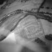
Oblique aerial view centred on the formal garden, farmhouse and farmsteading and the cropmarks of the Roman road, taken from the SE. |
6/1941 |
Item Level |
|
Photographs and Off-line Digital Images |
H 92184 PO |
General oblique aerial view centred on the cropmarks of the rig and possible enclosure, taken from the NNW. |
6/1941 |
Item Level |
|
Photographs and Off-line Digital Images |
H 92185 PO |
Oblique aerial view centred on the cropmarks of the rig, taken from the NNW. |
6/1941 |
Item Level |
|
Photographs and Off-line Digital Images |
H 92186 PO |
General oblique aerial view centred on the cropmarks of the field boundary and pits with the farmhouses and farmsteadings in the distance, taken from the WSW. |
6/1941 |
Item Level |
|
Photographs and Off-line Digital Images |
H 92187 PO |
General oblique aerial view centred on the cropmarks and the remains of the earthwork with the church, burial-ground, churchyard, manse and village adjacent, taken from the SW. |
6/1941 |
Item Level |
|
Photographs and Off-line Digital Images |
H 92188 PO |
Oblique aerial view centred on the church, burial-ground, churchyard, manse and remains of the earthwork, taken from the NW. |
6/1941 |
Item Level |
|
Photographs and Off-line Digital Images |
H 92189 PO |
Oblique aerial view centred on the cropmarks and remains of the earthwork with the church, churchyard, burial-ground and manse adjacent, taken from the SW. |
6/1941 |
Item Level |
|
Photographs and Off-line Digital Images |
H 92190 PO |
Oblique aerial view centred on the cropmarks of the Roman road with the country house adjacent, taken from the WNW. |
6/1941 |
Item Level |
|
Photographs and Off-line Digital Images |
H 92191 PO |
General oblique aerial view centred on the cropmarks of the Roman road with the farmhouse, farmsteading, formal garden, castle, country house, tower-house and bleach works adjacent, taken from the SW. |
6/1941 |
Item Level |
|
Photographs and Off-line Digital Images |
H 92192 PO |
Oblique aerial view centred on the formal garden, farmhouse and farmsteading and the cropmarks of the Roman road, taken from the SE. |
6/1941 |
Item Level |
|
Photographs and Off-line Digital Images |
H 92193 PO |
Oblique aerial view centred on the cropmarks of the Roman road and pits with the farmhouse, farmsteading and formal garden adjacent, taken from the N. |
6/1941 |
Item Level |
|
Photographs and Off-line Digital Images |
H 92195 PO |
General oblique aerial view centred on the cropmarks of the Roman road and pits with the farmhouse, farmsteading formal garden and cottages adjacent in the foreground, taken from the NNW. |
6/1941 |
Item Level |
|
Photographs and Off-line Digital Images |
H 92196 PO |
Oblique aerial view centred on the cropmarks of the road, taken from the SSW. |
6/1941 |
Item Level |
|
Photographs and Off-line Digital Images |
H 92197 PO |
Oblique aerial view centred on the parchmarks of the rig and Roman temporary camp with the remains of the weir adjacent, taken from the SE. |
6/1941 |
Item Level |
|
Photographs and Off-line Digital Images |
H 92198 PO |
General oblique aerial view centred on the cropmarks of the Roman fort with the railway viaduct in the foreground and the weir adjacent, taken from the WNW. |
6/1941 |
Item Level |
|
Photographs and Off-line Digital Images |
H 92199 PO |
Oblique aerial view centred on the golf course and the cropmarks of the rig and the pits, taken from the SW. |
6/1941 |
Item Level |
|
Photographs and Off-line Digital Images |
H 92200 PO |
Oblique aerial view centred on the parchmarks of the rig and Roman temporary camp, and the linear cropmarks, taken from the S. |
6/1941 |
Item Level |
|
Photographs and Off-line Digital Images |
H 92201 PO |
Oblique aerial view centred on the parchmarks of the rig and Roman temporary camp, and the linear cropmarks, taken from the SSW. |
6/1941 |
Item Level |
|
Photographs and Off-line Digital Images |
H 92202 PO |
Oblique aerial view centred on the parchmarks of the rig and Roman temporary camp, and the linear cropmarks, taken from the SE. |
6/1941 |
Item Level |
|
Photographs and Off-line Digital Images |
H 92203 PO |
Oblique aerial view centred on the cropmarks of the road, taken from the SSE. |
6/1941 |
Item Level |
|
Photographs and Off-line Digital Images |
H 92204 PO |
General oblique aerial view centred on the linear cropmarks, taken from the NNW. |
6/1941 |
Item Level |
|
Photographs and Off-line Digital Images |
H 92205 PO |
Oblique aerial view centred on the cropmarks of the road, taken from the ENE. |
6/1941 |
Item Level |
|
Photographs and Off-line Digital Images |
H 92206 PO |
Oblique aerial view centred on the cropmarks of the unenclosed settlement and souterrains, taken from the N. |
1992 |
Item Level |
|
Photographs and Off-line Digital Images |
H 92207 PO |
Oblique aerial view centred on the cropmarks of the fort and the sand and gravel quarry pits, taken from the NE. |
1992 |
Item Level |


