|
Digital Files (Non-image) |
GV 006337 |
HES Survey and Recording Illustration: Plan of Broomend of Crichie NJ71 NE9 (Stone 3). |
1/2017 |
Item Level |
|
Digital Files (Non-image) |
GV 006339 |
HES Survey and Recording Illustration: Plan of Broomend of Crichie NJ71 NE9 (Stone 2). |
1/2017 |
Item Level |
|
Digital Files (Non-image) |
GV 006341 |
HES Survey and Recording Illustration: Plan of Broomend of Crichie NJ71 NE9 (Stone 1). |
1/2017 |
Item Level |
|
Digital Files (Non-image) |
GV 006343 |
HES Survey and Recording Illustration: Plan of Bridgend of Lethnot. |
1/2017 |
Item Level |
|
Digital Files (Non-image) |
GV 006345 |
HES Survey and Recording Illustration: Plan of Brandsbutt. |
1/2017 |
Item Level |
|
Digital Files (Non-image) |
GV 006353 |
HES Survey and Recording Illustration: Plan of Fullerton. |
1/2017 |
Item Level |
|
Digital Files (Non-image) |
GV 006347 |
HES Survey and Recording Illustration: Plan of Gask. |
1/2017 |
Item Level |
|
Digital Files (Non-image) |
GV 006349 |
HES Survey and Recording Illustration: Plan of the Lang Stane O' Craigearn. |
1/2017 |
Item Level |
|
Digital Files (Non-image) |
GV 006351 |
HES Survey and Recording Illustration: Plan of the Candy Stone. |
1/2017 |
Item Level |
|
Digital Files (Non-image) |
GV 006331 |
HES Survey and Recording Illustration: Plan of Old Keig RSC |
3/2017 |
Item Level |
|
Digital Files (Non-image) |
GV 006333 |
Plan of South Brideswell. |
3/2017 |
Item Level |
|
Digital Files (Non-image) |
GV 006335 |
HES Survey and Recording Illustration: Plan of Broomend of Crichie NJ71 NE9 (Stone 4). |
1/2017 |
Item Level |
|
Digital Files (Non-image) |
GV 006375 |
HES Survey and Recording Illustration: Plan of Campstone Hill, Raedykes. |
1/2017 |
Item Level |
 |
On-line Digital Images |
SC 1555867 |
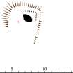
HES Survey and Recording Illustration: Plan of Broomend of Crichie NJ71 NE9 (Stone 4). |
1/2017 |
Item Level |
 |
On-line Digital Images |
SC 1555878 |
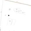
HES Survey and Recording Illustration: Plan of Broomend of Crichie NJ71 NE9 (Stone 3). |
1/2017 |
Item Level |
 |
On-line Digital Images |
SC 1555880 |
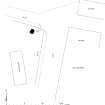
HES Survey and Recording Illustration: Plan of Broomend of Crichie NJ71 NE9 (Stone 2). |
1/2017 |
Item Level |
 |
On-line Digital Images |
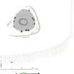
SC 1555882 |
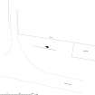
HES Survey and Recording Illustration: Plan of Broomend of Crichie NJ71 NE9 (Stone 1). |
1/2017 |
Item Level |
 |
On-line Digital Images |
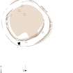
SC 1555884 |
HES Survey and Recording Illustration: Plan of Bridgend of Lethnot. |
1/2017 |
Item Level |
 |
On-line Digital Images |
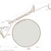
SC 1555984 |
HES Survey and Recording Illustration: Plan of Fullerton. |
1/2017 |
Item Level |
 |
On-line Digital Images |
SC 1555886 |
HES Survey and Recording Illustration: Plan of Brandsbutt. |
1/2017 |
Item Level |
 |
On-line Digital Images |
SC 1555888 |
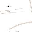
HES Survey and Recording Illustration: Plan of Gask. |
1/2017 |
Item Level |
 |
On-line Digital Images |
SC 1555890 |
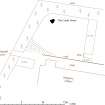
HES Survey and Recording Illustration: Plan of the Lang Stane O' Craigearn. |
1/2017 |
Item Level |
 |
On-line Digital Images |
SC 1555897 |
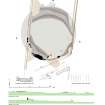
HES Survey and Recording Illustration: Plan of the Candy Stone. |
1/2017 |
Item Level |
 |
On-line Digital Images |
SC 1555833 |
HES Survey and Recording Illustration: Plan of Old Keig RSC. 400dpi copy of GV006331. |
3/2017 |
Item Level |


