|
Digital Files (Non-image) |
MV 000830 |
UAV video: Easdale Island and Slate Quarries |
5/10/2017 |
Item Level |
|
Digital Files (Non-image) |
MV 000831 |
UAV video: Easdale Island and Slate Quarries |
5/10/2017 |
Item Level |
|
Digital Files (Non-image) |
MV 000832 |
UAV video: Easdale Island and Slate Quarries |
5/10/2017 |
Item Level |
 |
On-line Digital Images |
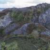
DP 264495 |
Oblique aerial view of south end Doune Quarry spoil from the north east. |
5/10/2017 |
Item Level |
 |
On-line Digital Images |
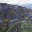
DP 264496 |
Oblique aerial view of Doune Quarry, post-1899 tramway with Windmill Quarry in the background. |
5/10/2017 |
Item Level |
 |
On-line Digital Images |
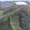
DP 264497 |
Oblique aerial of south west corner of Easdale Island showing flooded quarries, garden enclosures (pre-1872) and a later post-1899 tramway (centred at NM73549 17046) cutting through the earlier enclosures. |
5/10/2017 |
Item Level |
 |
On-line Digital Images |
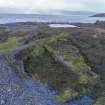
DP 264498 |
Oblique aerial of south west corner of Easdale Island showing flooded quarries, garden enclosures (pre-1872) and a later post-1899 tramway (centred at NM73549 17046) cutting through the earlier enclosures. |
5/10/2017 |
Item Level |
 |
On-line Digital Images |
DP 264499 |
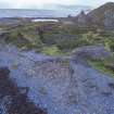
Oblique aerial of south west corner of Easdale Island showing flooded quarries, garden enclosures (pre-1872) and a later post-1899 tramway (centred at NM73549 17046) cutting through the earlier enclosures and the waste slate accumulated and eroded on the shoreline from the western quarries. The Klondyke Quarry (1890s) tramway is visible to the right of the image. |
5/10/2017 |
Item Level |
 |
On-line Digital Images |
DP 264500 |
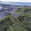
Oblique aerial view from north of south shoreline showing garden enclosures on top of slate waste. The waste along the south shore has been eroded by wave action. The pre-1872 garden enclosure at bottom left of the image shows how it is sitting at a lower level than the slate waste buildup against its outer walls. |
5/10/2017 |
Item Level |
 |
On-line Digital Images |
DP 264502 |
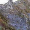
Oblique aerial view showing detail of western part of Klondyke Quarry |
5/10/2017 |
Item Level |
 |
On-line Digital Images |
DP 264503 |
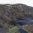
Oblique aerial view of Klondyke Quarry |
5/10/2017 |
Item Level |
 |
On-line Digital Images |
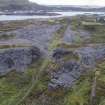
DP 264505 |
Oblique aerial view showing line of original tramway and the post-1899 tramway crossing - the bridge is now gone. |
5/10/2017 |
Item Level |
 |
On-line Digital Images |
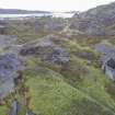
DP 264506 |
Oblique aerial view from west showing original tramway, post-1899 tramway, and the landscape towards the Village. |
5/10/2017 |
Item Level |
 |
On-line Digital Images |
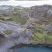
DP 264508 |
Oblique aerial view showing the post-1899 tramway and the eastern edge of Windmill Quarry. |
5/10/2017 |
Item Level |
 |
On-line Digital Images |
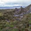
DP 264511 |
Oblique aerial view of Klondyke Quarry from the east |
5/10/2017 |
Item Level |
 |
On-line Digital Images |
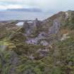
DP 264512 |
Oblique aerial view of Klondyke Quarry from east looking towards quarry faces and slate waste |
5/10/2017 |
Item Level |
 |
On-line Digital Images |
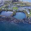
DP 264514 |
Oblique aerial view |
5/10/2017 |
Item Level |
 |
On-line Digital Images |
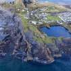
DP 264515 |
Oblique aerial view of south east spoil, walls and workings around NGR NM739 168 at A Charraig Ruadh (or the Red Rock or Quarry) |
5/10/2017 |
Item Level |
 |
On-line Digital Images |
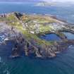
DP 264516 |
Oblique aerial view of south east spoil, walls and workings around NGR NM739 168 at A Charraig Ruadh (or the Red Rock or Quarry) |
5/10/2017 |
Item Level |
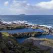 |
On-line Digital Images |
DP 264431 |
Oblique aerial view showing western quarries from north |
5/10/2017 |
Item Level |
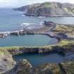 |
On-line Digital Images |
DP 264432 |
Oblique aerial view of Windmill and Hill Quarries from southeast |
5/10/2017 |
Item Level |
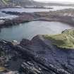 |
On-line Digital Images |
DP 264433 |
Oblique aerial view showing Windmill Quarry and the shore quarrying and erosion from south east |
5/10/2017 |
Item Level |
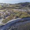 |
On-line Digital Images |
DP 264434 |
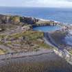
Oblique aerial view showing the garden enclosures overlying earlier slate waste and slate waste tipping |
5/10/2017 |
Item Level |
 |
On-line Digital Images |
DP 264435 |
Oblique aerial view showing waste with overlying garden enclosures and eroded slate waste tipping from north |
5/10/2017 |
Item Level |


