 |
On-line Digital Images |
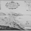
SC 1021875 |
Bernera Barracks
Drawing showing perspective view of general site with explanation, titled: 'A Prospect of the Part of the Land and Sea adjacent to y Barrack to be Built in Glen Elg. taken and Drawn By John Bastide'. |
1720 |
Item Level |
|
Print Room |
J 13954 PO |
Hermitage of Braid.
Photographic copy of plan of Barony of Braid.
Titled: 'A Plan of the Barony of Braid with the Hermitage and Policie. The Property of Charles Gordon Esq. Surveyed July 1772 by John Home.'
Scale 1":5'. |
7/1772 |
Item Level |
|
Print Room |
A 45062 PO |
Photographic copy of Board of Ordnance drawing with plans, elevations and sections of 'Ruthven of Badenoch', Fort Augustus 'Killewhiman', Inversaid 'Inversnait' and Bernera barracks. |
c. 1719 |
Item Level |
|
Prints and Drawings |
KCD 32/13 P |
North elevation of shed. |
c. 1890 |
Item Level |
|
Prints and Drawings |
DBD 9/3 |
Mechanical copy of drawing showing plan. |
1709 |
Item Level |
|
Prints and Drawings |
DBD 9/4 |
Mechanical copy of drawing showing plan. |
1709 |
Item Level |
|
Prints and Drawings |
DBD 9/5 |
Floor plans and sections. |
1719 |
Item Level |
|
Prints and Drawings |
DBD 9/6 |
Floor plans and sections. |
1719 |
Item Level |
|
Prints and Drawings |
DBD 9/7 |
Floor plans and sections. |
1719 |
Item Level |
|
Prints and Drawings |
DBD 9/8 |
Drawing of a design for a powder magazine proposed to be built at Dumbarton Castle. |
1748 |
Item Level |
|
Prints and Drawings |
DBD 9/12 |
Mechanical copy of drawing showing pland, elevations and sections. |
|
Item Level |
|
Prints and Drawings |
DBD 9/14 |
Mechanical copy of drawing of plan of castle and two views by Slezer. |
|
Item Level |
|
Prints and Drawings |
DC 40989 |
Map of the lands around Langwell, Rogart parish. map no.xviii |
|
Item Level |
|
Prints and Drawings |
DC 40990 |
Map of the lands around Langwell, Rogart parish. map no.xvii |
|
Item Level |
|
Prints and Drawings |
DC 40991 |
Map of the lands around Langwell, Rogart parish. map no.xvi |
|
Item Level |
|
Prints and Drawings |
DC 40992 |
Plan of the low ground of Rogart, surveyed in October 1831 |
10/1831 |
Item Level |
|
Prints and Drawings |
DC 40993 |
Plan of Kintrad, Davochbeg, Pitintrail and Rovie Craigtown |
|
Item Level |
|
Prints and Drawings |
RXD 267/35 |
Minto House
Elevation of ogee roof, insc: (verso) 'Mr Adam ball top of my roof' |
1740 |
Item Level |
|
Prints and Drawings |
STD 96/3 |
Tracing of plan of site, titled 'A plan of the Barrack at Inversnait. Anno 1725 [1719?]' |
c. 1960 |
Item Level |
|
Prints and Drawings |
RXD 267/36 |
Minto House
Plan showing elevation of walls of Octagon Room |
1740 |
Item Level |
|
Prints and Drawings |
RXD 267/37 |
Minto House
Bedroom floor plan |
1740 |
Item Level |
|
Prints and Drawings |
RXD 267/38 |
Minto House
Floor plan showing 18th Century addition of stairs |
1740 |
Item Level |
|
Prints and Drawings |
RXD 267/33 |
Minto House
Elevation of new window and details of iron trusses, insc: (verso) 'New Window' |
1740 |
Item Level |
|
Prints and Drawings |
RXD 267/34 |
Minto House
Elevation of a window, insc: (verso) 'Window...' |
1740 |
Item Level |


