|
Digital Files (Non-image) |
GV 006977 |
Plan of the archaeological landscape of Glen Banchor, Adobe Illustrator format |
c. 11/1996 |
Item Level |
|
Digital Files (Non-image) |
GV 006978 |
Plan of the archaeological landscape along the Allt a Chaorainn, Glen Banchor, Adobe Illustrator format |
c. 11/1996 |
Item Level |
|
Digital Files (Non-image) |
GV 006979 |
Plan of the archaeological landscape around the Milton of Glenbanchor, Adobe Illustrator format |
c. 11/1996 |
Item Level |
|
Digital Files (Non-image) |
DX 001433 |
RCAHMS Structures Database - Kingussie Survey |
1995 |
Item Level |
|
Digital Files (Non-image) |
TM 000354 |
Zip file containing survey data for the RCAHMS Afforestable Land Survey of the Kingussie Area, 1995. Data is held as digital 1:10000 map overlays and a final composite DXF file |
1995 |
Item Level |
|
Digital Files (Non-image) |
TM 002199 |
Zip file containing survey data for the RCAHMS Afforestable Land Survey of the Kingussie Area, 1995. SHP and Geojson file formats with extra attribution added to the linework. |
1995 |
Item Level |
 |
On-line Digital Images |
SC 1768469 |
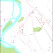
Plan of the archaeological landscape around the Milton of Glenbanchor |
c. 11/1996 |
Item Level |
 |
On-line Digital Images |
SC 1768470 |
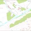
Plan of the archaeological landscape of Glen Banchor |
c. 11/1996 |
Item Level |
 |
On-line Digital Images |
SC 1768471 |
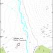
Plan of the archaeological landscape along the Allt a Chaorainn, Glen Banchor |
c. 11/1996 |
Item Level |
 |
On-line Digital Images |
SC 1768477 |
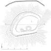
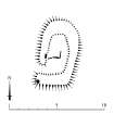
Publication drawing; palisaded enclosure, Sidhean Mor Dail A'Chaorainn, Glen Banchor |
11/1996 |
Item Level |
 |
On-line Digital Images |
SC 1768478 |
Plan of shieling hut on the Allt An T-seillich |
c. 11/1996 |
Item Level |
 |
On-line Digital Images |
SC 1768479 |
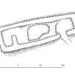
Plan of byre-house and building, Dail Na Seilg (KING95 108 and 109) |
11/1996 |
Item Level |
 |
On-line Digital Images |
SC 1768507 |
Plan of shieling hut |
c. 11/1996 |
Item Level |
|
Manuscripts |
MS 731/18 |
Afforestable Land Survey field database (Kingussie survey, 1995). Held as attribute table in GIS and in Oracle Field/AP table. Please see DX001433 |
1995 |
Item Level |
|
Prints and Drawings |
DC 42914 |
Survey Drawing: Plan of palisaded enclosure, Sidhean Mor Dail A'Chaorainn |
20/11/1995 |
Item Level |
|
Prints and Drawings |
DC 42915 |
Publication Drawing: Plan of palisaded enclosure. |
16/4/1997 |
Item Level |
|
Prints and Drawings |
DC 42911 |
Publication Drawing: Plan of shieling-hut |
28/8/1998 |
Item Level |
|
Prints and Drawings |
DC 42912 |
Survey Drawing: Plan of building in township.
|
24/11/1995 |
Item Level |
|
Prints and Drawings |
DC 42910 |
Survey Drawing: Plan of shieling-hut |
23/11/1995 |
Item Level |
|
Prints and Drawings |
DC 42913 |
Publication drawing: Plan of building in township.
|
8/9/1998 |
Item Level |
|
Prints and Drawings |
DC 42908 |
Survey Drawing: Plan of farmstead within township. |
22/11/1995 |
Item Level |
|
Prints and Drawings |
DC 42909 |
Publication Drawing: Plan of farmstead within township. |
13/6/1997 |
Item Level |


