Accessibility

Font Size

100% 150% 200%

Background Colour

Default Contrast
Close Reset

Archive of illustrations associated with archaeological survey at Cracknie Souterrain, Tongue

551 5/14/30/1

Description Archive of illustrations associated with archaeological survey at Cracknie Souterrain, Tongue

Date 20/2/2012 to 22/2/2012

Collection Records of AOC Archaeology Group, archaeologists, Loanhead, Midlothian, Scotland

Catalogue Number 551 5/14/30/1

Category All Other

Accession Number 2012/106

Permalink http://canmore.org.uk/collection/1595436

Collection Hierarchy - Sub-Group Level

Preview Category Catalogue Number Title Date Level
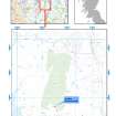
Digital Files (Non-image) Digital Files (Non-image) WP 004823 Location map of Cracknie Souterrain, shown in context of wider geographical area in N of Scotland 20/2/2012 Item Level
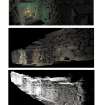
Digital Files (Non-image) Digital Files (Non-image) WP 004824 Perspective views of Cracknie souterrain 20/2/2012 Item Level
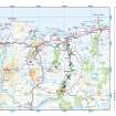
Digital Files (Non-image) Digital Files (Non-image) WP 004825 Cracknie heritage context map 20/2/2012 Item Level
Digital Files (Non-image) GV 006555 Ground and reflected ceiling plans and sections of Cracknie Soutterain 20/2/2012 Item Level
Digital Files (Non-image) GV 006556 Internal East, West and Buttress Elevations at Cracknie Souterrain 20/2/2012 Item Level
Digital Files (Non-image) GV 006557 Plans and elevations of Rosal souterrain 20/2/2012 Item Level
On-line Digital Images On-line Digital Images DP 267623 Cracknie souterrain, laser scan images 20/2/2012 Item Level
On-line Digital Images On-line Digital Images DP 267624 Cracknie souterrain, laser scan images 20/2/2012 Item Level

People and Organisations

Events