|
Digital Files (Non-image) |
GV 006508 |
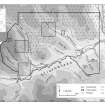
Map showing extent of Afforestable Land Survey in Strathbraan and location of case studies. |
1996 |
Item Level |
|
Digital Files (Non-image) |
GV 006509 |
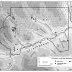
Distribution map of prehistoric and early medieval settlement. |
1996 |
Item Level |
|
Digital Files (Non-image) |
GV 006510 |
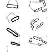
Comparative plans of Pitcarmick-type buildings and 19th century steadings. |
1996 |
Item Level |
|
Digital Files (Non-image) |
GV 006511 |
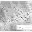
Distribution map of medieval and later settlement. |
1996 |
Item Level |
|
Digital Files (Non-image) |
GV 006512 |
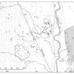
Plan of archaeological landscape at Glen Cochill |
1997 |
Item Level |
|
Digital Files (Non-image) |
GV 006513 |
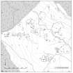
Plan of archaeological landscape at Ballinloan Burn |
1997 |
Item Level |
|
Digital Files (Non-image) |
GV 006514 |
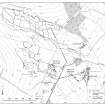
Plan of archaeological landscape at Glen Fender |
1997 |
Item Level |
|
Digital Files (Non-image) |
GV 006515 |
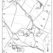
Plan of Salachill townships. |
1997 |
Item Level |
|
Digital Files (Non-image) |
TM 000319 |
Zip file containaing the final survey linework dxf file for the RCAHMS Afforestable Land Survey of Strathbraan 1993, the individual 1:10000 map sheet overlay dxf files, OS Antiquity model dxf files and a document detailing the files and the survey methodology. |
1993 |
Item Level |
|
Digital Files (Non-image) |
DX 001430 |
RCAHMS structures database (Strathbraan survey) |
1993 |
Item Level |
|
Digital Files (Non-image) |
TM 002206 |
Zip file containaing the final survey linework for RCAHMS Afforestable Land Survey of Strathbraan 1993. SHP and Geojson file formats with extra attribution added to the linework. |
1993 |
Item Level |
 |
On-line Digital Images |
DP 266703 |
Map showing extent of Afforestable Land Survey in Strathbraan and location of case studies. |
1996 |
Item Level |
 |
On-line Digital Images |
DP 266704 |
Distribution map of prehistoric and early medieval settlement. |
1996 |
Item Level |
 |
On-line Digital Images |
DP 266705 |
Comparative plans of Pitcarmick-type buildings and 19th century steadings. Generated from RCAHMS computer file DC37329.ai. |
1996 |
Item Level |
 |
On-line Digital Images |
DP 266706 |
Distribution map of medieval and later settlement. Generated from RCAHMS computer file DC37330ai. |
1996 |
Item Level |
 |
On-line Digital Images |
DP 266707 |
Plan of archaeological landscape at Glen Cochill |
1997 |
Item Level |
 |
On-line Digital Images |
DP 266708 |
Plan of archaeological landscape at Ballinloan Burn |
1995 |
Item Level |
 |
On-line Digital Images |
DP 266709 |
Plan of archaeological landscape at Glen Fender |
1996 |
Item Level |
 |
On-line Digital Images |
DP 266710 |
Plan of Salachill townships. |
1996 |
Item Level |
 |
On-line Digital Images |
SC 2254550 |
View of hut-circle (Braan93 120) |
1993 |
Item Level |
|
Manuscripts |
MS 731/13 |
Printout of Afforestable Land Survey field database (Strathbraan survey) |
1993 |
Item Level |
|
Manuscripts |
MS 989/1 |
Afforestable Land Survey: Strathbraan survey 1993. SDR and Autocad plots |
1993 |
Item Level |
|
Prints and Drawings |
DC 37330 PO |
Distribution map of medieval and later settlement. Generated from RCAHMS computer file DC37330ai. |
1996 |
Item Level |
|
Prints and Drawings |
DC 37331 PO |
Plan of archaeological landscape. Generated from digital file DC 37331.tif |
1997 |
Item Level |


